
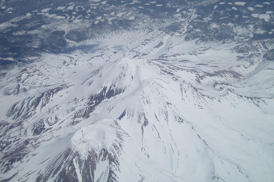
 Mt. Shasta, which last erupted in 1786 and is still considered 'active'
I love flying. Yeah, I hate the hassles of flying, but I love being in the air, getting a map's-eye view of the landscape (yes, I am a map junkie), trying to identify every landmark, to know exactly where I am at all times. I could spend hours staring at the land from the air.
The cool thing about flying up to the Northwest is that you get to see the whole line of the Cascades, from Lassen in the south to Rainier in the north. You get a sense of the entirety of the biggest and most active volcanic region in the Lower 48.
More below the fold... You can see here how the Oregon Cascades are a big, rolling lava plateau with occasional volcanic cones poking up. This one is Mt. McLoughlin. Fourmile Lake (still frozen, left of Mt. McLoughlin) is one of thousands of lakes on the plateau.
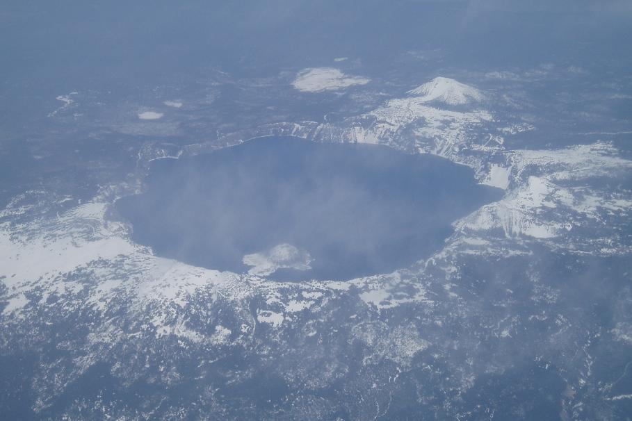 Mt. Mazama was a 12,000' peak when it blew up some 7,000 years ago to form the Crater Lake caldera.
 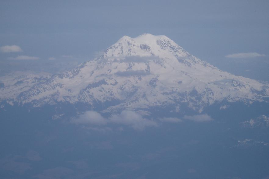 Mt. Rainier is the granddaddy of them all, and could well be the next to erupt. It's a lot closer to urban areas than Mount St. Helens was, so the devastation would be enormous.
[That's all, folks]
Thursday, May 11, 2006
Ring of Fire
Subscribe to:
Comment Feed (RSS)
|