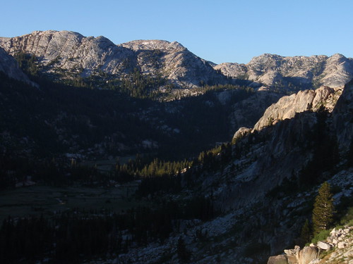
Up and moving by 6:45 on day 3. I was expecting this to be my most difficult day: something like 6 miles of off-trail hiking, according to the Topo! route. Back when I first planned this trip, I thought I'd camp near Rock Island Lake; on closer inspection, I decided the camping didn't look great there (too exposed, no shade) and it made for a long hike out, so I'd be better off pressing on to Snow Lake. So I had what looked like a long day ahead of me.
The ramp out of Slide Canyon (visible on the topo as a diagonal notch running roughly north) is choked with talus and willow in the lower reaches; fortunately, there are low-angle slabs to the east of it so you can bypass that section. Aim for a prominent rust-stained cliff, which happens to be the exact point where the talus and willow end. Once you're on the (surprisingly broad) ramp, it's easy going: just follow it up.
More...
The stream shown on the map actually drops into the canyon sooner than the map shows; you'll start hearing it when you're halfway up or more. When the terrain started to open out, I bore left, skirting the southern edge of the big meadow at the top. This area is just magical: wide-open alpine meadowlands surrounded by classic Yosemite outcrops, and (once you're on the broad saddle) great views down Crazy Mule Gulch. 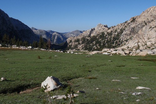
You make your way through this beautiful and easy terrain toward the obvious knob to your west. Easy slopes lead up to the best crossing of this ridgelet, at a forested notch immediately north of the knob. From here you descend a short ramp and then a short sandy slope into the gully to the west. Follow up the gully a little ways, then zigzag west to the top of Suicide Ridge, following the plethora of low-angle ramps that lead you up and west. At a broad flat atop the ridge, I angled northish through a nice granite alley and emerged to my first view of Rock Island Lake. 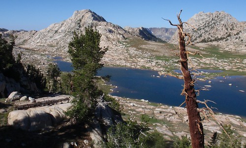
Which is really an extraordinary lake: a mile or so long, nestled in a vast meadowy valley, a landscape so open and inviting you can almost picture living there.
Zigzag ramps lead quickly down to the gentle slopes nearest the lake. I followed the lakeshore north and crossed the inlet stream just a little ways past the north end, with the aim of cutting directly west to the western slopes of the valley and the most direct shot up to the next pass. This was not a bad plan, but the turf is pretty hummocky in places; it might have been slightly easier crossing the valley a upstream a ways. Once across, though, it's an easy, gentle angle right up to the pass.
From the pass, my goal was to traverse over to Rock Island Pass while losing as little elevation as necessary to avoid the most difficult terrain. A series of benches lead inexorably lower, but as long as you keep heading northish as you drop you should be fine. The slopes gentle out some after a while, and at this point you want to stay level or gain elevation. I came out right in the big meadow, and hooked up with the trail about 100 yards before the pass.
Just a short hop down the trail and I was at Snow Lake. Which I reached at...a few minutes after 11 am. The whole route went so smoothly that it wound up seeming like the easiest day rather than the hardest. 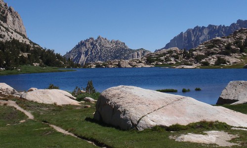
I took a cursory look around for campsites here. Not finding much, and being less than thrilled by the stiff wind blowing steadily through Rock Island Pass, and in light of how early it still was, I decided to continue on to Crown Lake. 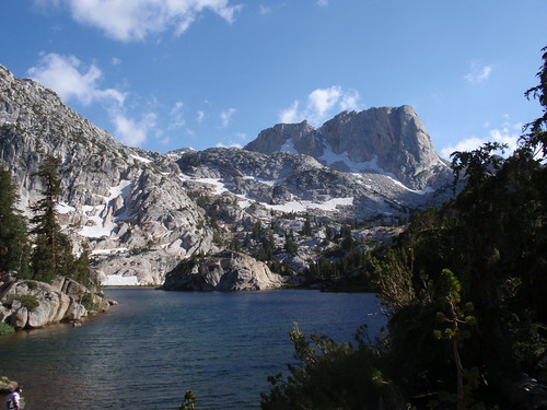
Where I found a secluded campsite well away from the group of eight who were my nearest neighbors.
That night the wind never stopped. There's white noise, and then there's white noise: the sound of a nearby stream can be wonderfully relaxing, but the sound of the wind unsettles me and puts me on edge. It was not a restful night.
Nevertheless, I was up and on the trail by 6:36 am. Not much worth telling about the rest of the trip, beyond my supreme annoyance at the trail builders. Three crossings of Robinson Creek in a quarter mile? Those ridiculous switchbacks up and then down before Barney Lake? What on earth were they thinking?
Oh, and one more thing. In the last flat tedious section of trail, approaching the campground, as I was wanting nothing so much as to be at my car already, I stopped to talk with a couple who were hiking in. I asked where they were going, and the man said Rock Island Lake. So I described my route, and it turned out that they were thinking about doing that same stretch between the lake and Slide Canyon (except possibly in reverse). They were iffy, because they weren't sure about the ramp up from the canyon. I described in detail what I had done and what landmarks to look for, and told them what a sweet route that ramp really is, and enthused over Rock Island Lake and environs. And when we parted I felt a whole lot better: here, in the most tedious part of the whole journey, they had given me the opportunity to relive the most enjoyable part of it all.
Part 1
Part 2
Tuesday, August 31, 2010
Yosemite/Hoover Wilderness Trip Report: Part 3

Monday, August 30, 2010
Yosemite/Hoover Wilderness Trip Report: Part 2
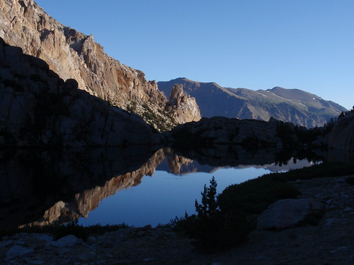
Next morning I was up and on the trail before 7 am. My goal today was Slide Canyon a couple miles below the slide, at the base of the ramp I needed to follow over toward Rock Island Lake.
I had a short scramble down a loose sandy chute into the eastern gully, where I picked up another use trail that nicely avoided the worst of the big-block talus choking the upper gully. This trail continues to Ice Lake, conveniently leading above the cliffs on the eastern side, before petering out near the south end of the lake.
At the lake I ran into a couple who were just starting to stir (one still sleeping, the other starting the stove), so I stopped and chatted for a bit; this was the last person I saw until I was back on the Robinson Creek Trail.
More...
Ice Lake Pass was a narrow gully with a long snowfield; the snow was still hard and icy that early in the morning, so I stayed on the dry slopes to the west. This opened onto a gorgeous meadowy mini-valley. Tons of flowers here: Brewer's Lupine, Lemmon's Paintbrush, Elephant Heads, Monkeyflower, red Paintbrush, among others. This area is a cross-country dream: a gentle stepped descent from meadow to meadow, with glimpses of Matterhorn Peak appearing to your left. Bear generally right and downstream and you can't really go wrong. 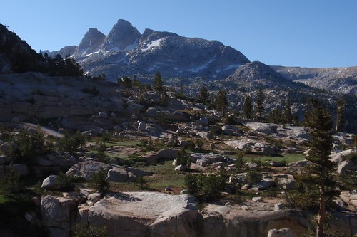
Picked up the trail a little below the largest meadow, and followed it down the switchbacks to the long traverse east. Left the trail near the low point of the traverse, and angled down to an easy crossing of Piute Creek a little above the confluence with the unnamed creek from the north. Easy, gentle descent in here, with the biggest obstacle being down trees (but not so many of them that you can't wind around them). Came out in the meadow above the Slide.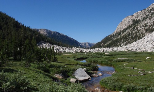
The Slide is the product of a massive rockfall hundreds of years ago--a rockfall so huge that it covers the width of the canyon and extends a ways up the other side. I had read somewhere that there was a use trail leading above on the east side of the canyon, so I angled left and a little up in search of it. Turns out there is a faint sort of an intermittent use trail; if you lose it at any point, just head uphill and you'll probably run into it (it did seem to go higher than was strictly necessary to avoid the talus maze).
Once back down on the canyon floor, it's easy meadow-and-slab walking--just a cross-country dream. Some ways down (maybe 3/4 mile or so) the vegetation started getting thicker and dewier, so I crossed Piute Creek to the drier and more open west side; this worked well generally, although I did have to go uphill a short ways to avoid a steep streambank in one spot.
I had been slightly concerned about identifying the right ramp from below (in MacClure's account, he makes it sound like it was nearly invisible), but I needn't have worried: it's unmistakeable, especially if you use the granite spur across the canyon as a marker. I pitched camp in a gravelly patch at the very base of the slabs I would follow up to MacClure's ramp.
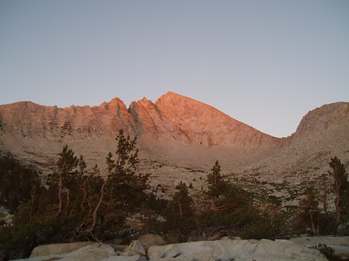
Mosquitoes came out in the early evening; this was the one place where there were enough to be bothersome. I took a stroll up the slabs around sunset to enjoy the late sun on Sawtooth Ridge, then--as it was getting dark--retired to my tent to read a while before bed.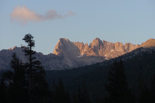
Part 1
Part 3
Friday, August 27, 2010
Yosemite/Hoover Wilderness Trip Report: Part 1
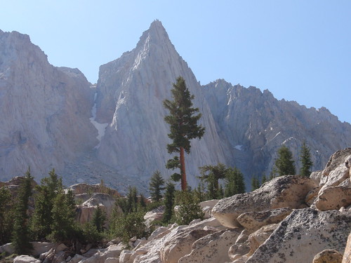
Did my first-ever trip into Yosemite's north boundary country a couple weeks ago: a 4-day trip in via Little Slide Canyon, down Slide Canyon, over to Rock Island Lake, and out via Snow Lake and the Robinson Creek Trail. Great area, and a really cool route.
I drove up Saturday morning, arriving at Bridgeport by noon. I headed straight to Buckeye Campground to secure a spot (turned out there were plenty, and it never did fill up--on a Saturday in August), then turned around and headed for the ranger station to grab a permit (again, no problem). Then up to Twin Lakes and Mono Village Resort to check out trailhead logistics (you have to pay $10 to park for up to a week), which turned out to be a very good thing because the entry station doesn't open until [i]8:00 am[/i] (by which time, of course, half the day is gone). Back to Buckeye for an evening bottle of Brother Thelonius and a (relatively) good night's sleep.
Next day I was packed and parked and on the 'trail' (the first 1/4 mile or so goes right through the campground) by 7:09 am. The first stretch of trail is easy, flat or gentle rise, first through forest then breaking out into sagebrush slopes with nice views of the whole valley.
More...
My first challenge: catching the best route into Little Slide Canyon. As it happens, Secor's directions are pretty solid, with one slight recent wrinkle: the Hoover Wilderness expansion last year moved the wilderness entry sign out to about 1 mile (or slightly more) before the LSC turnoff (instead of 1/4 mile after). I figured this out, so it wasn't a problem. The 'table-shaped' rock isn't quite as table-shaped as Secor thinks, IMO, but it's still recognizable from that description, at the edge of a small grove of a half dozen or so pine trees. Once you're there, the 'faint use trail' is actually pretty distinct (thanks to Secor, I assume), and remains distinct much of the way up the canyon.
From the table rock, the use trail cuts over to an easy snag crossing of Robinson Creek (as Secor says). Across the creek, it immediately starts climbing south and west up the slopes east of LSC. After gaining ~600' the trail turns the corner into the canyon, and shortly thereafter you start to get some good up-canyon views. Early morning shade kept it nice and cool all through this part. 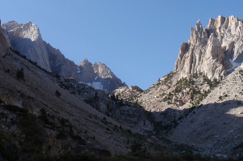
The trail traverses over to the creek and crosses it, then climbs steeply through an open rocky/talus-y section (prominent cliffs on the other side of the stream) to an idyllic subalpine bench. Slogging up this steep stuff, I set my eye on a prominent lone tree at the top of the cliffs with the promise to myself that as soon as I got there I would take a nice long break.
Which, having gained about 2/3 of the day's elevation, I did.
Now, the wildflowers had been getting steadily better and better as I climbed--from dried-up lupine and mule ear husks down along the main trail, to slightly-past-their-prime mint climbing up the shoulder, to a variety of blooms once I turned into the shade of the canyon, to the subalpine zone where it was still prime wildflower season. The late spring was definitely paying off for me just as I hoped it would.
After resting a while, I started back up the trail--a little less distinct here, fading out in places, with fewer ducks than before. Generally, though, if you follow Secor's description you'll end up in pretty much the right place. Once past the cliffs, you veer left, cross the stream, and head up the east fork a ways. Somewhere in this section I started to think I heard voices, then after a little bit I was sure of it; and then I spotted the climbers on their way up The Incredible Hulk.
It gets a little trickier here: to get to Maltby Lake, you want to veer off to the right up one of the ravines crisscrossing the granite mass separating the two canyon branches. I'm not sure just how to identify the right one, but after losing and then finding the trail a couple times I got to exactly where I was supposed to be: where the trail drops to the Maltby Lake outlet stream and ascends the gully to the lake.
Just one problem: a high-angle corniced snowfield/bridge filling the gully. I took some time looking at this, and looking for alternate possibilities in the immediate vicinity (they all deadended), and looking at the snowbridge again, and thinking maybe and maybe not, and in the end I decided I just couldn't chance it. 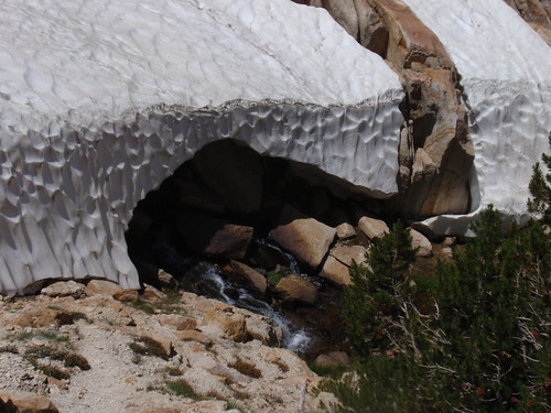
So I backtracked a ways to see if I could find another route through and over the granite maze keeping me away from my destination. What I found was a nice sandy flat with a tremendous view of the whole canyon and, up front and center, the Incredible Hulk. I dropped my pack and rested a bit, then explored a bit more to see if there was a reasonable way over to Maltby. Not finding anything promising, I had my campsite.
I spent the rest of the afternoon reading and watching the climbers descend--the last of them racing against the thunderstorm that had been building up all day. 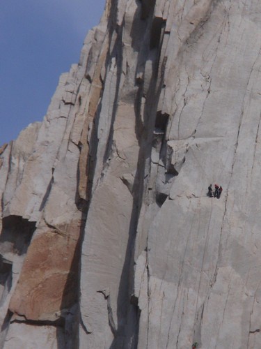
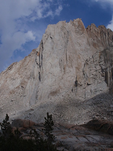
(See the orange rock in the first pic? It's visible to the left of the vertical shadows in the second; the three climbers are visible as a speck to the right of that.)
It started raining a little before 5 pm, so I ducked into my tent; by 6:30 it had stopped, but a brisk freezing wind kept it kind of unpleasant to stay outside, so I wound up having cheese & crackers for dinner and retiring early.
Part 2
Part 3
Saturday, July 18, 2009
Trinity Alps Trip Report: Part 2
Part 1
Next day, with a leisurely start, we still got moving by about 6:30 am. Originally, the plan was to head to Diamond Lake today, then to Deer Lake the following day--basically adding the Four Lakes Loop onto the Anna Lake loop. After talking with Don and Griff about the limited campaing and Deer and Diamond, we decided to camp two nights at Summit Lake instead, and do the Four Lakes Loop as a dayhike.
In theory, this was an easier day than day 1: less mileage, much less gain. We headed south from Lake Anna and up the low ridge (dodging some lingering snowfields), then down to Billy Be Damn Lake. So far, so good. More... 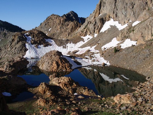
Circling Billy Be Damn on the west made me a little nervous, sidehilling on steepish and very loose slopes (on the right, above), and for some reason it seemed more difficult than it normally would. We caught up with a use trail that traversed over to a steep but straightforward gully (more loose stuff) up to the notch.
Here's where it got...interesting.
The other side was a steep chute with extremely loose gravel, scree, and a few talus-sized rocks that could really cause some damage if they got moving. Lou went down first, and I gave him plenty of space before I started down myself. At which point, flailing my way down this mess, I realized I had pretty much lost my mountain legs. Still recovering from the day before, I was unsteady on my feet on a slope that was unstable to begin with--decidedly sub-optimal. Eventually I made my way down to where I could get out of the scree chute and onto terra firmer, and then continued the descent to Echo Lake. 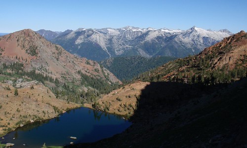
On the way down, we got our first views of the Granite Trinities--quite a contrast with the assorted metamorphics of our part of the range (the 'Red Trinities'). One of the things that impressed me about this area was the amazing variety of landscapes within a fairly compact range.
We caught up with the trail just before Little Stonewall Pass, ending the off-trail portion of the trip. The pass is a very short climb, then a switchbacking descent to a level traverse through open forest above Lower Siligo Meadow. Lots of Phlox in this section, and a fair amount of Flax. Paintbrush, Red Heather, Cinquefoil--all the usual stuff. Not as spectacular as Bowerman Meadows, but here and for the rest of the trip there were consistently plenty of wildflowers to look at. 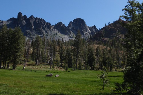
Soon we reached the near edge of lower Upper Siligo Meadow. The trail has been rerouted around the meadow here--good for the meadow, and good for us, since it looked pretty boggy in places. Skirting the meadow on the west, we came around to the north side and started up the riser to the upper Upper meadow. Only 200' or so of climbing, but somehow it seemed endless. I think this is where we realized how much the morning's cross-country, and the previous day's workout, had taken out of us.
Another brief bit of level walking through upper Upper Siligo Meadow, then another 200' or so of switchbacking ascent to Deer Creek Pass. 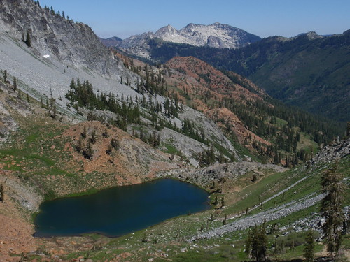
At this point, we were getting pretty tired--still recovering from the day before. Not too happy, then, about the drop from Deer Creek Pass, knowing we had to make it all back and more. From here to Summit Lake it was a long traverse through a shadeless moonscape of talus and sparse brush, plus a few extra-extra-long switchbacks up to the ridgeline; I can't complain about the grade, but I can complain about the distance. Along the way I did spot a tiny stand of Copeland's Speedwell, a rare species limited to the Klamath Mountains. Still: hot and tired, and still climbing.
Finally we came out at the ridgetop--no, actually, there were still two more hidden switchbacks, as if to mock us--and then we came out at the ridgetop and got our first views of Summit Lake. A painless descent on the spur trail, and we were there. We set up at a spacious campsite with some excellent sitting rocks and a good firepit just a little bit south of the trail's end. Summit isn't as strikingly beautiful as the lakes we had seen so far, but it's pretty enough; the delicate pink Lewisia growing all around us brightened things.
Another lazy afternoon; a game of Scrabble and a game of cribbage, both of which Lou won, and happy hour, where everyone's a winner. After dinner Lou built a roaring fire (or, in his phrase, caveman television). And then to bed. 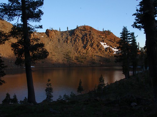
Next morning we slept in until nearly 6 am. (Because we could. So there.) After a leisurely breakfast, we secured our food in the bear canister and started out on the day's hike.
First on the agenda was summiting Siligo Peak. It's a pretty easy walk-up; we started straight up the slope from the Summit Lake trail junction, and headed up toward a notch in the ridge. At the notch we picked up a use trail that got us through the brush on the higher slopes. From the trail it took us maybe 25 minutes to the top. 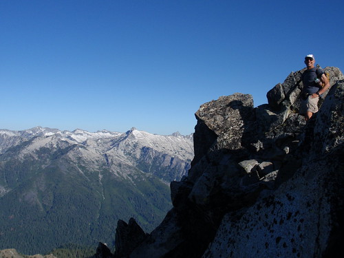
Siligo isn't the highest thing around (~8,160 or so), but the big valleys that surround it open up tremendous views of the whole Trinity Alps area: Middle Peak to the southeast, Gibson to the east, Deer Creek Valley and Seven Up Peak to the northeast, and the whole solid line of the Granite Trinities to the west.
Coming down, we got into a tangle of use trails for a while but found our way back to the gap, from which the original use trail took us straight down to the trail at the Deer Creek/Summit saddle.
Next up: Diamond Lake, on a bench over looking the Stuart Fork canyon; the pictures of Diamond had motivated me to check out this part of the Trinities in the first place. It did not disappoint. Descending to the lake, every switchback is another spectacular view; along the trail, lots of Mountain Mint, Western Blue Flax, and Wallflower. 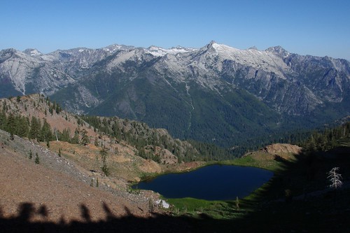
Down at the lake, we wandered over to the outlet area to check out the view. Lush (slightly boggy) meadows, with Corn Lilies, Bog Orchids, and Reed Lilies providing vertical punctuation, against a backdrop of classic alpine granite. Only one campsite at the lake, though, which is one of the reasons we decided to do it on a dayhike instead of camping here.
Back on the trail and a gentle forested climb up to the ridge above Luella Lake, then a long descent in which Luella never seems to get any closer until you're almost there. From the lake down to the floor of Deer Creek Valley is the best wildflower display since Bowerman Meadows: Scarlet Gilia, Larkspur, Paintbrush, Yellow Lupine, Stonecrop everywhere. 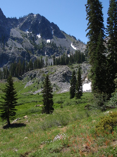
Climbing up from the bottom of Deer Creek Valley, we couldn't help but be conscious of how much more arduous it would have been with packs on. We stopped for lunch about 2/3 of the way up to Deer Lake, then resumed climbing. We came out at Deer lake and hit the shoreline and...clouds of gnats. Gnats that would land on us and die. In great numbers. It wasn't like they were biting or anything, but it was kind of creepy.
Starting up from the far end of Deer Lake we passed through a garden of Western Pasque Flower, smaller versions of which I had seen at Lake Anna. When these go to seed they look like big fluffy mops; one guidebook suggests that they were the inspiration for Truffula Trees.
The least fun part of the day was revisiting the long, long traverse and switchbacks we had done before. Much easier without packs, though. We got into camp around 1:30 pm and had the rest of the afternoon to be lazy. Reading, happy hour, dinner, fire, etc.; all in all, one exceptionally fine day in the mountains. 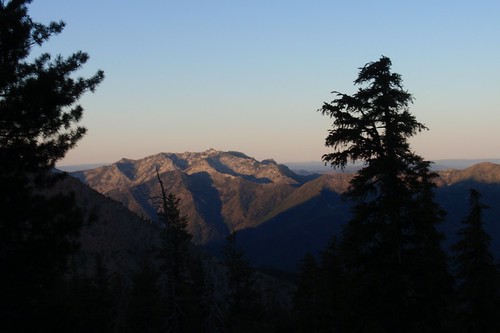
And up at 4:49 the next morning for the hike out; figuring it would get hot in the low country, we wanted as early a start as possible. We were hiking shortly after 6 am, and made good progress, hitting Bee Tree Gap after an hour. Upper Long Canyon is lovely, all alpine meadows and peaks and expansive views, and we passed through another Pasque Flower garden right at the point where you would cut off the trail to Lake Anna. 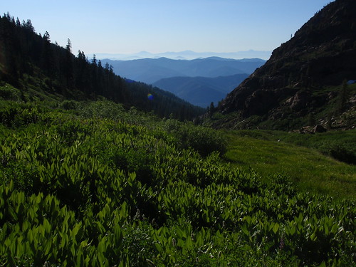
Further down I was expecting it to be mostly boring, but was pleasantly surprised: there we were lots of meadowy sections, and profuse wildflowers--our old friend the Naked Mariposa LIly, Scarlet Gilia, Mountain Spiraea, and so on. Sort of a nice lagniappe for that get-out-to-the-trailhead-fast last day. Just before the Bowerman Meadows turnoff, we passed a gorgeous stand of Washington Lily, one last burst of wildflowers before the end.
Back to the car around 10 am, and on the road shortly thereafter. As I said to Lou as we were approaching Vacaville, you spend 4 days in the wilderness filled with lovely peaceful thoughts of nature and then you spend 6 hours on the freeway recovering your misanthropic view of humanity.
But it's worth it.
Thursday, July 16, 2009
Trinity Alps Trip Report: Part 1
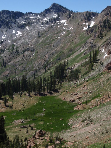
My plan this year was to do three trips this year in areas where I had never backpacked before. The first was out of the Sierra altogether, in the Trinity Alps (in the northwest quadrant of the state). It's an area I've been thinking about for years: it's a big wilderness (500,000+ acres); it has some of the very few truly alpine areas in California outside the Sierra; and it was reportedly great wildflower country. With a lot of help from Messrs. Linkhart and White, I put together a planned loop with several lakes, some interesting cross-country, and a whole lot of wildflower potential: from Long Canyon Trailhead to Anna Lake, Diamond Lake, Deer Lake, and then out. The downside: a 3,700' gain the first day, with the toughest (off-trail) part coming at the end of the hike.
At some point I managed to get my buddy Lou interested enough to come along...despite his misgivings about the first day's climb. We met at his place the morning before, and drove up together--with stops in Redding (for the Sundial Bridge) and Weaverville (for lunch and a tour of the Joss House). We crashed out at the trailhead so we would get the most time at the highest possible elevation and the earliest possible start.
Good thing, because when we hit the trail at 6:00 am we could tell it was going to get good and warm.
More...
The Long Canyon trail starts out steep and just keeps climbing. The good news was that it was all shaded in the early stretch, which kept it cool; the bad news was that it was also pretty boring. We chugged along in low gear, steady and slow. At about two miles we got to the Bowerman Meadows trail, dropped down to cross Long Creek, and started climbing again on the other side. 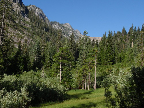
After a short climb we got to the first small meadow, the first good views of the cliffs above, and the first of the Naked Mariposa Lilies that were so spectacular in the upper meadows. Then another longer climb away from the stream, and a traverse through a boggy section chock full of wildflowers: Leopard Lilies, Bog Orchids, Crimson Columbine, etc.
Three words about the wildflowers in this section (from this point to the valley headwall): Anne. Croy. Obbler. Whole fields of Mariposa Lilies, Cinquefoil, Yarrow, and Scarlet Gilia and Larkspur for highlights; underfoot, easy to miss, lots of tiny Monkey Flowers.
After another short climb we came out into a large open area, the main body of Bowerman Meadows. This is where I think we went wrong. We followed the obvious trail to where it sort of petered out at the edge of the forest. We picked up something that looked like a trail that led toward the stream, and then died a horrible death in a willow thicket. Huh.
So we backtracked a bit and then headed straight up the open slopes, figuring we might get the views needed to better orient ourselves, and at any rate the going would likely be easier higher up. A couple hundred feet up we got to a sort of bench, where we found...trail. Apparently when we got to the main meadow, we should have looked for a faint trail heading upslope instead of following the beaten path on the level. (Linkhart and White actually describe this, by the way.)
From here it was straightforward on-trail hiking, traversing the slope with a gentle climb up to the flat below the headwall. It's an idyllic spot--lush meadow, mountain stream, dramatic cliffs, and the cascading stream out of Lake Anna--so we took a break here and planned out the off-trail portion of the day's hike. 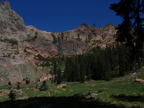
Moving again, we started the climb. Following Linkhart & White's directions, we followed the Lake Anna outlet stream for a ways, until the grade got steeper, then turned and angled right (northish) up the ridge. It's a steep climb with some loose stuff (not too bad, but watch your footing) and large patches of brush to find your way through or around. The best bet is to stay left of the large outcrop (described as a 'boulder' in the book) and just keep climbing; when you get to what looks like the ridgetop the grade eases up and you have a short further climb to a saddle on the true ridgetop.
We were tired, but feeling okay--believing, naively, that the hard part was over.
Following the book, we turned left here and headed up a short steep gully. At the top...ugh: snow choked the gully down the other side, which would have been the natural route. At first it looked like we needed to traverse across the large snowfield to a gap high on the left--not an encouraging prospect.
Then I remembered what it said in the book: "make a short descent into this basin, traverse around the base of the cliffs, and head up to a minor ridge on the opposite side." There was a clear notch on the opposite ridge, so we figured that was our route. We clambered cautiously down the rocks to the less-precipitous slopes below, and angled up to the notch on the other side.
And once again: cliffs and snow. This is the point at which I really started feeling exhausted. The troublesome thing here was not just the steep-angled snowfield itself, but also the gap one had to cross to get on it in the first place. Again, we eased our way down the rocks to where the snowfield was a little more level. Here, Lou got onto the snow with a tricky move off a narrow foothold; not trusting my rubbery legs, I followed the snow gap (just wide enough to walk through) to the lower edge of the snowfield.
Now we were in the gully north of Lake Anna, and it was pretty easy from here...or would have been, if I weren't so wiped. (I did, however, have enough energy to stop and shoot the Glacier Lilies I spotted along the way.) The gully seemed endless, and there was at least one false crest along the way. 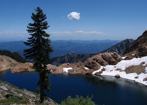
At the top of the ridge, with the lake finally in view, I was ready to drop at the closest campsite. (All of the feasible campsites at Lake Anna are well above the lake, on a high bench.) Lou was not; he wanted the best campsite. "Didn't anyone ever tell you that adequate is good enough?" I asked him, rhetorically. In fairness to Lou, he did find us a pretty swell site that wasn't too much further: great view, level sleeping sites, and water (the inlet stream) was just a short level jog to the south (rather than a steep descent to the lake and climb back up).
We settled into camp around 1 pm, a good 7 hours after setting out that morning. Reading, napping, a little whiskey--an afternoon spent recovering from the day's hike.
Later, early evening, Lou and I wandered over to chat with Don and Griff, two guys from Portland camped on the saddle north of Lake Anna. (Also a swell view: while we could see east as far as Mt. Lassen, they looked out at Mt. Shasta.) Very nice guys, generous with the hooch and knowledgeable about the area--and after talking with them we wound up altering our trip plans (wisely) on the basis of their information.
Then back to camp, dinner, and bed.
Part 2
Thursday, July 17, 2008
Mokelumne Trip Report
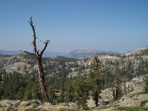
First trip of the season was a short, not-too-difficult jaunt with my buddy Lou in Mokelumne Wilderness out of Blue Lakes--location and timing chosen mostly for the wildflowers. More...
When we left Friday morning, the Bay Area was blanketed in thick ugly smoke from hundreds of wildfires all over the state. Of course, if it was as smoky as this up in the mountains, there wouldn't be much point in doing the trip at all. The smoke continued through the Central Valley and into the foothills. By Carson Pass we were mostly above it; distance views would be smoky, but at least we had blue sky above us. 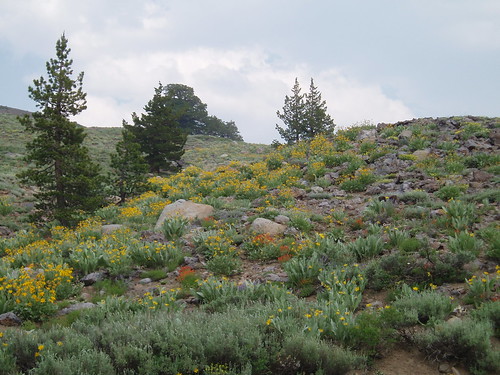
The road through Hope Valley delivered on the promise of wildflowers: mule ears, paintbrush, lupines, penstemon, and lots more. We snagged the last spot at Middle Creek campground between Blue Lakes, 1/4 mile from the trailhead. (Turns out there was another campground even closer, with lots of vacant spaces.)
We hit the trail around 7:30 Saturday morning. The trailhead had moved since my last trip here; it's now right by the boat launch, and you walk across a little bridgelet over the spillway to get to the trail. You follow the opposite bank of the runoff channel for about a hundred yards, then cross the outlet stream on a good log that's been there since Max and I first came here in 1996. Across the stream, we were briefly confused by a trail uphill that petered out in mud and snags; the real trail continues downstream a little ways before turning uphill. Intermittent snowfields and muddy patches were no more than a minor annoyance. 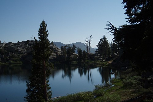
We took a short break at Granite Lake, where Max and I had camped on his first couple of backpacking trips. Lots of mosquitoes here--no surprise--so we didn't linger.
West of Granite Lake the views open up to the south. Lots of wildflowers all along here, especially penstemon. 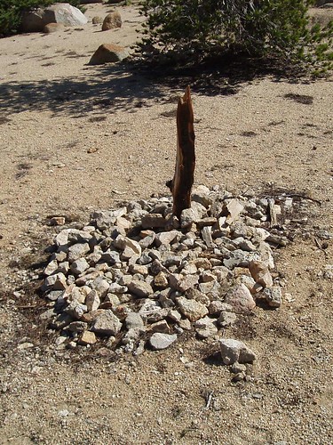
About a mile up the trail there's a spot marked 'Grave' on the topo. The marker doesn't say who's buried here (if it ever did), and Google is no help. Some anonymous prospector, I guess. 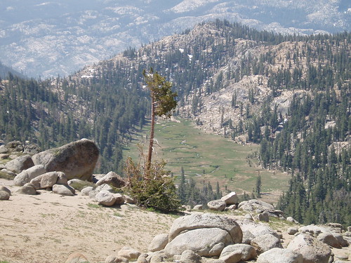
A little past the gravesite the trail runs 300' straight up a ridgelet (hello? switchbacks?) to a more-or-less level traverse above the head of Snow Canyon. The trail runs just below the contact zone between granite and volcanic rock above. You can trace the discontinuity on the topo along a series of springs: water is stored in the porous volcanic rock, and makes its way to the surface where it hits the impervious granite.
The trail petered out near a big snowfield on the near side of the ridge east of Grouse Lake. We angled up to a low point on the ridge, then contoured north and picked up the trail again. We lost it again dropping down a gully to the ridgelet between Grouse Lake and Grouse Creek (nice field of stickseed here), but the terrain was pretty obvious. We picked it up again after dropping a little to the north, and it stayed with us all the way to the lake. 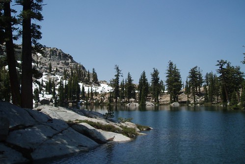
Grouse Lake is lovely, the perfect mix of granite cliffs and forested shores and views of the higher peaks. We turned the lake on the north side and angled up the low ridge to the west. We dropped our packs just before noon at a nice spacious campsite atop the ridge, with plenty of wind (to keep the skeeters down) and views of Summit City Canyon. 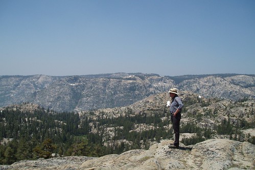
Spent the afternoon reading, exploring the lake, and getting my ass kicked at Scrabble.
Next morning we were on the trail around 7:15, headed for either Deadman or Snow Canyon (we figured we'd decide once we got a view from the top of the ridge. We backtracked on trail until the ridgelet, then set out across the Grouse Creek valley to climb the slope on the south side (visible on the topo map as a less-steep portion of the ridge, due north of the '2' in '21'). 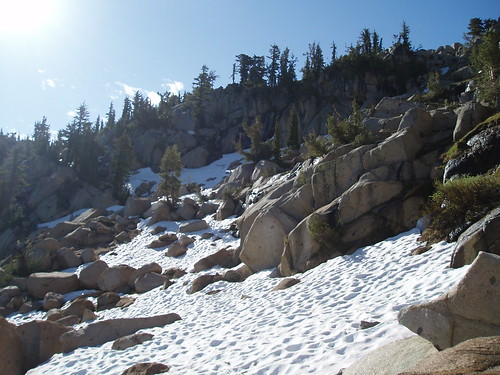
Not too difficult most of the way up, although near the top we had some loose sandy stuff and a couple largish snowfields to cross. We made the ridgetop before nine--early enough that there wasn't a lot of smoke to ruin the view. 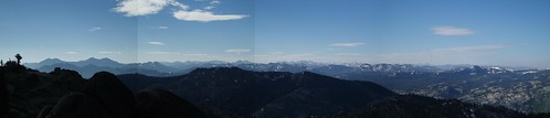
At this point, we decided to head for Snow instead of Deadwood--partly to have a shorter hike out (Lou's back was bothering him), and mostly because those swampy patches on the map promised big mosquito action. From the ridge we dropped down a shallow gully to the obvious wet meadow below. At the far end of the meadow, the fun began: we were going against the grain of the granite, a series of ribs and gullies trending maybe 45 degrees off our intended direction. With a lot of zigzag ups and downs and a certain amount of backtracking, we eventually made it to the big flat saddle between Snow Canyon and Deadwood Canyon.
From here a ravine (visible as a notch on the topo) angled northeast into the canyon, promising a direct route down. Or not. The ravine bottom got steep and narrow and chockstonealicious, we wound up sidehilling on some steepish loose stuff, and after a bit we angled out of the ravine altogether and onto gentler, more stairstepped slopes down into the canyon. 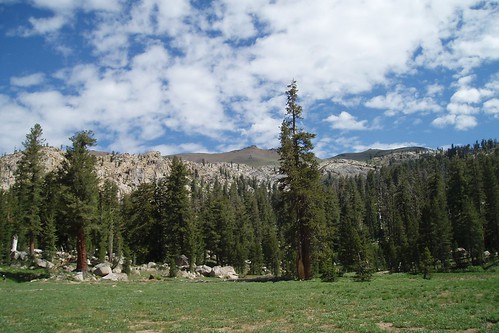
Snow Canyon is a great spot--a big flat half-mile-long meadow nestled in a forested bowl, with stark volcanic Deadwood Peak looming over it all. We snagged a swell campsite (complete with an elaborate illegal firepit, which of course we didn't use) in the woods at the northwest edge of the meadow, near the western tributary to the main stream. Mosquitoes weren't too bad, considering. Had another lazy afternoon reading, exploring the valley, and getting beaten at Scrabble (but by a much narrower margin).
Next morning we headed east, paralleling the eastern tributary stream up to the big meadowy bench at 8600'. Max and I had camped here once, on his first off-trail trip; there's a nice big open sandy area perfect for setting up shop. From here we went a little astray, angling away from the stream a little too soon and a little too far and winding up further south on the ridge than we had intended. Not huge; we followed the ridge north with only minimal scrambling, and caught the trail in the meadow northeast of point 8850. 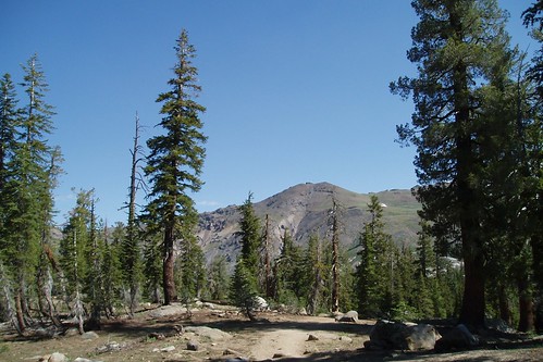
All uneventful from here, apart from briefly losing the trail in a snowfield. We got back to the car before 10 and headed home through surprisingly heavy and slow traffic on 50.
Great trip. Short, and none too ambitious; but it's some beautiful country, and we sure got the wildflowers we were looking for.
Saturday, August 25, 2007
Mono Divide Trip Report: Part 2
Part 1
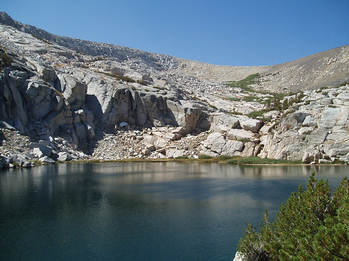
Shortly after I got to Recess Peak Lakes, the wind had started--a fairly steady wind, with gusts of maybe 30 mph or so. The kind of wind that drives people crazy if it goes on for weeks at a time. It died down for a while after sunset, then picked up again in the middle of the night and just kept going--making for a restless, chilly night.
And, of course, a cold morning. I had intended to take my time and maybe do a little exploring before I set out--I had a short hiking day--but with the wind at full strength and a couple of hours yet before the first sun (Recess Peak, positioned perfectly for alpenglow, shades the lake well into morning), I had ample inducement to get moving. I actually started out hiking with a jacket on, which I never do, just because it was so cold and windy.
I headed northish, contouring at about 10,800', around the ead of the next valley and over to the next low ridge. On the other side of the second ridge I got into a lunarish-microlandscape of bare sand and krummholz cut by a series of shallow ravines; rather than fight the ravines, I went a little out of my way and dropped down into the lush (volcanic spring-fed) valley southeast of Volcanic Knob--where I finally got into the sunlight. 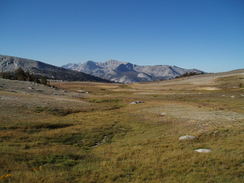
From there it was easy walking up to the saddle overlooking First Recess. There's a great view from here down the Recess and into Mono Creek Canyon, and across to the dramatic cliffs and peaks of the Silver Divide...but while I was shooting straight down into the canyon, the wind started gusting even more strongly, and I started getting very nervous about being that close to the edge. 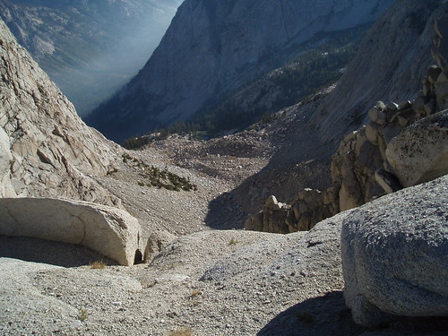
So I backed away and continued roughly WNW up the ridge, aiming to hit the ridgeline at a point where I could drop directly to the saddle north of Volcanic Knob, from which I could get to a gentler (i.e., not cliffs) way down into One Halfth Recess. It worked out pretty well, and from the ridgetop there was an obvious way down into the Recess, right at the contact zone between granite and volcanic. 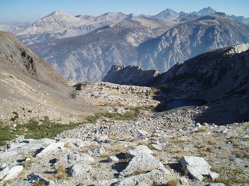
There's a short stretch of loose sand and rock at the top, with a sort of use trail belaboring the obvious. Half-buried in the sand was a crumpled beer can, sun-bleached beyond recognition but for a bit around the rim identifying the culprit as Anheuser Busch, that had been there (apparently) since the long-ago days of pull tabs. This was jarring, but the beer can and the bit of sort-of trail were the only signs of visitation I saw in this basin.
After the loose stuff, the easiest way is near the left edge of the willows, then through a gap in the willows further down to a gully just before a granite cliff band that blocks the upper lake. I scrambled up the low cliff and onto the slabs, but the easier way is just to follow it up to the contact zone, where you can walk across to another gully leading down to the lake. From there it's easy strolling past the lower lake. 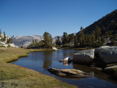
I set up camp in a little grove northeast of the lower lake outlet, hoping for a bit of windscreen. The wind wasn't howling the way it had been up on the ridge, but it wasn't exactly still either. I spent yet another lazy afternoon, reading and exploring the basin, every now and then ambling over to the slabs below the lower lake for a grand view of the Silver Divide. The wind finally died down around dinner time, and evening and night were blissfully peaceful. 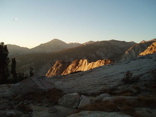
I got up well before the cracko, figuring I had a long hike out, and made a quick breakfast by headlamp light. Judging from my photo timestamps, I got on the trail around 6:30 or so. I followed the gully up from the upper lake to the top (the contact zone), and then retraced yesterday's steps up to the base of the loose stuff. Here I went for the slightly less loose stuff on the volcanic side, rather than fighting the sand I had come down. I headed south and up to the krummholz forest on Volcanic Knob ridge. 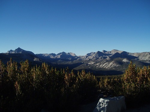
My plan at this point was to follow the curve of the spur ridge south then southwest then west, the idea being to hit the big meadow where I could find the trail again. Everything went beautifully, for a while--an easy stepped descent down gentle slopes and along meadowed benches. Then suddenly it was a lot steeper, in a place where it shouldn't have been steep if I had been where I thought I was.
After some puzzled map-reading, I figured it out: I had dropped too low on the southeast slope of the ridge, and was on the wrong side from where I wanted to be. I had to traverse west (and a little up, just to be safe) around the southern end of the ridge; when it got gentler, I knew I was in good shape again. I continued through the gentle forested slopes west to the meadow, where I found the trail.
From here it was a straight shot down, retracing my steps. To my surprise, when I got to the car it was just 10:30--I was expecting it to be a full hour later than that.
Another trip with some sub-optimal circumstances, that nevertheless wound up being an enjoyable, interesting, and spectacular adventure.
Friday, August 24, 2007
Mono Divide Trip Report: Part 1
There comes a time when everyone's plansOnce again, the trip I did wasn't the trip I planned. It didn't start out very well, but it wound up being a great (3-day rather than 4-day) trip to some truly spectacular and isolated spots.
Fall like a dog from a truckbed grandstand,
Fall like red snow on the freeway...
--Thin White Rope
Day 1
This was not a good day.
My plan was to take the Bear Creek Cutoff trail over to Bear Creek, then head up to the vicinity of Hilgard Branch--potentially a 12-mile day. Second day would be up to Apollo Lake, then over to Cirque on Day 3, and out via Marcella on Day 4.
I had been unable to get an advance reservation, so I had to wait to get a permit until High Sierra Ranger Station opened at 8 am. That meant I wasn't on the trail until 8:45, which is maddeningly late by my standards. It was already pretty warm by the time I started out, and obviously shaping up to be a hot one, which made the late start all the more annoying.
The day really went south when I was over the rim and heading down toward Bear Creek, and started wondering if I had locked my car. The further I went, the more certain I was that I hadn't. I really, really didn't want to go back (I was a good 3 miles in by now), and tried talking myself into a whole whatever happens happens type deal, all the while going further and further in. The thing that finally tore it (by which time I had hiked about 4 miles) was when I thought about the practical implications of the worst-case scenario: no wallet, no cash, no ATM card, no credit cards--no way to buy mogas to get home. That, as they say, would be bad.
So I turned around and slogged back to the trailhead, hot, tired, and demoralized. The car was, in fact, unlocked.
I did, however, have a plan to salvage the trip. I decided to car-camp that night, get an extra-early start the next morning, and do a 3-day version of my Plan B trip (which I had come up with when I couldn't get the permit reservation). This was to go up the Bear Ridge Trail to the JMT junction, then continue up a use trail to the lakes below Recess Peak. Then I'd head to the valley west of First Recess (skipping First Recess itself, which I'd have done on the 4-day version), or One Halfth Recess as I call it, then hike out on the third day.
So I lazed away the rest of the afternoon and camped that night at Bolsillo Campground--a lovely spot, if you like the smell (and sounds) of horses (but it's free, so you get what you pay for)--and worried about the next day's (net) 3200' climb.
Day 2
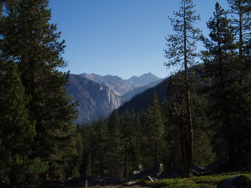
I was up at 5:15, out of camp by 6:00, and on the trail a little before 7 am. It was a little cooler this morning, and the trail was well-shaded (on the northwest side of the ridge, so it wouldn't get sun until mid-morning), which made the hiking a lot more pleasant. It's a sandy, sometimes-rocky trail, but the grade isn't too bad. The views aren't much (the flip side of the shade), but a couple miles in you get a nice look up toward the Silver Divide.
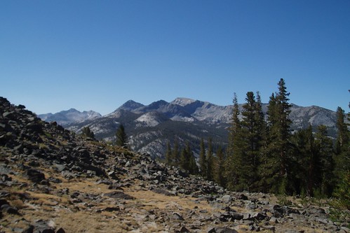
After about three hours of steady slogging, I got to the JMT junction, and the start of an unsigned trail up toward Recess Peak Lakes. This trail is easy to follow for the first mile or so, then peters out when it reaches the big meadow at 10,200'.
This area is an oddity on the Mono Divide: a sizable area of volcanic rock (not meta-volcanic, like the Minarets, but honest-to-god volcanic, as in an old lava flow) such as you'd find much further north, around Carson Pass or thereabouts. The local landscape is one of big sweeping meadows and wooded ridges, with the aptly named Volcanic Knob (it's a knob, and it's volcanic) presiding over it all.
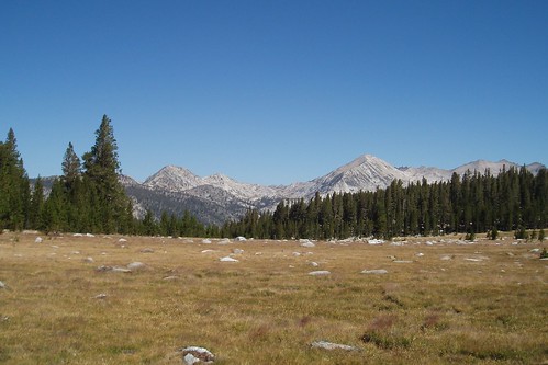
Rather than try to track down the trail, I just climbed the gentle slope up the ridge east of the meadow. (I'm impatient with intermittent trails, and I'd rather just make my own way than try to follow a 'trail' that isn't clear.) From atop the ridge I was able to contour (more or less) into the big meadow east of the ridge. To my surprise, the stream there was flowing--a function of the volcanic landscape, in which water seeps into the rock rather than remaining on the surface.
I continued over the next slight ridge (back in granitic country) and contoured around the head of the next valley, then crossed a large area of granite and sparse whitebark (this is more complicated than it looks on the map, because you're going against the grain of the granite, and the route is cut with a series of small gullies). This took me to the north shore of the upper Recess Peak Lake.
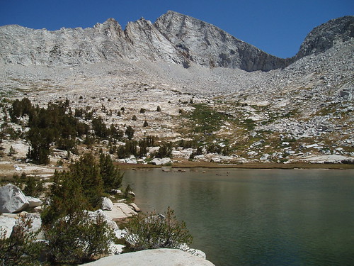
I dropped my pack earlier (not too long after noon) and feeling much better than I had expected--the benefit of an extra day of acclimatizing, an early start, and psyching myself up for the difficulty of the hike.
I ate lunch and spent another lazy afternoon reading, with occasional leisurely exploration of the basin. After dinner, as the sun started getting low, I went down to the western corner of the lake to catch the alpenglow, which I figured would be prime (Recess Peak facing due west and all). I was not disappointed.
Part 2