
Did my first-ever trip into Yosemite's north boundary country a couple weeks ago: a 4-day trip in via Little Slide Canyon, down Slide Canyon, over to Rock Island Lake, and out via Snow Lake and the Robinson Creek Trail. Great area, and a really cool route.
I drove up Saturday morning, arriving at Bridgeport by noon. I headed straight to Buckeye Campground to secure a spot (turned out there were plenty, and it never did fill up--on a Saturday in August), then turned around and headed for the ranger station to grab a permit (again, no problem). Then up to Twin Lakes and Mono Village Resort to check out trailhead logistics (you have to pay $10 to park for up to a week), which turned out to be a very good thing because the entry station doesn't open until [i]8:00 am[/i] (by which time, of course, half the day is gone). Back to Buckeye for an evening bottle of Brother Thelonius and a (relatively) good night's sleep.
Next day I was packed and parked and on the 'trail' (the first 1/4 mile or so goes right through the campground) by 7:09 am. The first stretch of trail is easy, flat or gentle rise, first through forest then breaking out into sagebrush slopes with nice views of the whole valley.
More...
My first challenge: catching the best route into Little Slide Canyon. As it happens, Secor's directions are pretty solid, with one slight recent wrinkle: the Hoover Wilderness expansion last year moved the wilderness entry sign out to about 1 mile (or slightly more) before the LSC turnoff (instead of 1/4 mile after). I figured this out, so it wasn't a problem. The 'table-shaped' rock isn't quite as table-shaped as Secor thinks, IMO, but it's still recognizable from that description, at the edge of a small grove of a half dozen or so pine trees. Once you're there, the 'faint use trail' is actually pretty distinct (thanks to Secor, I assume), and remains distinct much of the way up the canyon.
From the table rock, the use trail cuts over to an easy snag crossing of Robinson Creek (as Secor says). Across the creek, it immediately starts climbing south and west up the slopes east of LSC. After gaining ~600' the trail turns the corner into the canyon, and shortly thereafter you start to get some good up-canyon views. Early morning shade kept it nice and cool all through this part. 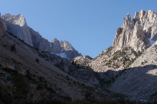
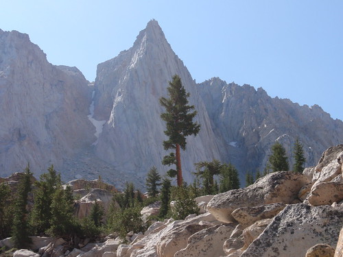
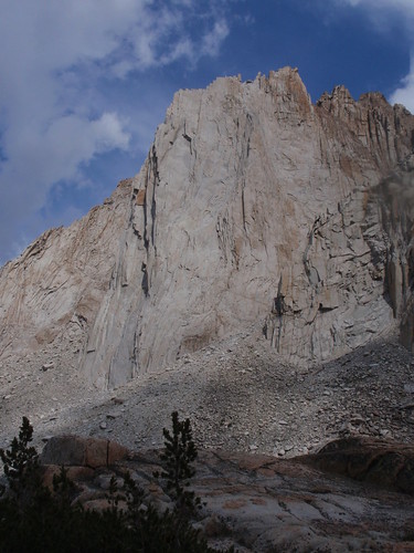
The trail traverses over to the creek and crosses it, then climbs steeply through an open rocky/talus-y section (prominent cliffs on the other side of the stream) to an idyllic subalpine bench. Slogging up this steep stuff, I set my eye on a prominent lone tree at the top of the cliffs with the promise to myself that as soon as I got there I would take a nice long break.
Which, having gained about 2/3 of the day's elevation, I did.
Now, the wildflowers had been getting steadily better and better as I climbed--from dried-up lupine and mule ear husks down along the main trail, to slightly-past-their-prime mint climbing up the shoulder, to a variety of blooms once I turned into the shade of the canyon, to the subalpine zone where it was still prime wildflower season. The late spring was definitely paying off for me just as I hoped it would.
After resting a while, I started back up the trail--a little less distinct here, fading out in places, with fewer ducks than before. Generally, though, if you follow Secor's description you'll end up in pretty much the right place. Once past the cliffs, you veer left, cross the stream, and head up the east fork a ways. Somewhere in this section I started to think I heard voices, then after a little bit I was sure of it; and then I spotted the climbers on their way up The Incredible Hulk.
It gets a little trickier here: to get to Maltby Lake, you want to veer off to the right up one of the ravines crisscrossing the granite mass separating the two canyon branches. I'm not sure just how to identify the right one, but after losing and then finding the trail a couple times I got to exactly where I was supposed to be: where the trail drops to the Maltby Lake outlet stream and ascends the gully to the lake.
Just one problem: a high-angle corniced snowfield/bridge filling the gully. I took some time looking at this, and looking for alternate possibilities in the immediate vicinity (they all deadended), and looking at the snowbridge again, and thinking maybe and maybe not, and in the end I decided I just couldn't chance it. 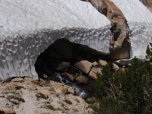
So I backtracked a ways to see if I could find another route through and over the granite maze keeping me away from my destination. What I found was a nice sandy flat with a tremendous view of the whole canyon and, up front and center, the Incredible Hulk. I dropped my pack and rested a bit, then explored a bit more to see if there was a reasonable way over to Maltby. Not finding anything promising, I had my campsite.
I spent the rest of the afternoon reading and watching the climbers descend--the last of them racing against the thunderstorm that had been building up all day. 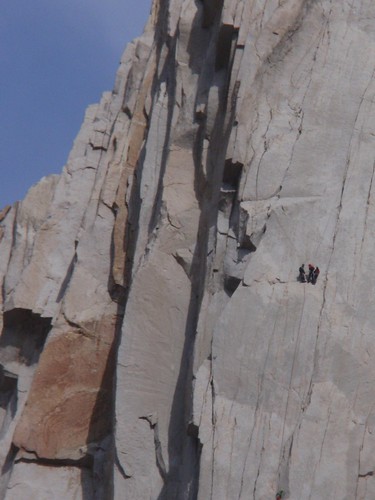
(See the orange rock in the first pic? It's visible to the left of the vertical shadows in the second; the three climbers are visible as a speck to the right of that.)
It started raining a little before 5 pm, so I ducked into my tent; by 6:30 it had stopped, but a brisk freezing wind kept it kind of unpleasant to stay outside, so I wound up having cheese & crackers for dinner and retiring early.
Part 2
Part 3
Friday, August 27, 2010
Yosemite/Hoover Wilderness Trip Report: Part 1
Subscribe to:
Comment Feed (RSS)
|