
Part 1
Shortly after I got to Recess Peak Lakes, the wind had started--a fairly steady wind, with gusts of maybe 30 mph or so. The kind of wind that drives people crazy if it goes on for weeks at a time. It died down for a while after sunset, then picked up again in the middle of the night and just kept going--making for a restless, chilly night.
And, of course, a cold morning. I had intended to take my time and maybe do a little exploring before I set out--I had a short hiking day--but with the wind at full strength and a couple of hours yet before the first sun (Recess Peak, positioned perfectly for alpenglow, shades the lake well into morning), I had ample inducement to get moving. I actually started out hiking with a jacket on, which I never do, just because it was so cold and windy.
I headed northish, contouring at about 10,800', around the ead of the next valley and over to the next low ridge. On the other side of the second ridge I got into a lunarish-microlandscape of bare sand and krummholz cut by a series of shallow ravines; rather than fight the ravines, I went a little out of my way and dropped down into the lush (volcanic spring-fed) valley southeast of Volcanic Knob--where I finally got into the sunlight. 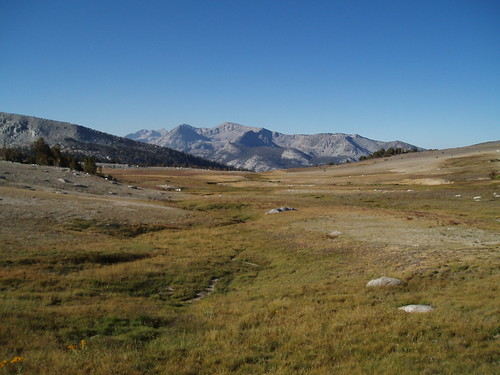
From there it was easy walking up to the saddle overlooking First Recess. There's a great view from here down the Recess and into Mono Creek Canyon, and across to the dramatic cliffs and peaks of the Silver Divide...but while I was shooting straight down into the canyon, the wind started gusting even more strongly, and I started getting very nervous about being that close to the edge. 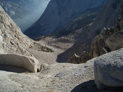
So I backed away and continued roughly WNW up the ridge, aiming to hit the ridgeline at a point where I could drop directly to the saddle north of Volcanic Knob, from which I could get to a gentler (i.e., not cliffs) way down into One Halfth Recess. It worked out pretty well, and from the ridgetop there was an obvious way down into the Recess, right at the contact zone between granite and volcanic. 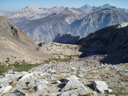
There's a short stretch of loose sand and rock at the top, with a sort of use trail belaboring the obvious. Half-buried in the sand was a crumpled beer can, sun-bleached beyond recognition but for a bit around the rim identifying the culprit as Anheuser Busch, that had been there (apparently) since the long-ago days of pull tabs. This was jarring, but the beer can and the bit of sort-of trail were the only signs of visitation I saw in this basin.
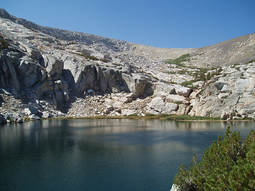
After the loose stuff, the easiest way is near the left edge of the willows, then through a gap in the willows further down to a gully just before a granite cliff band that blocks the upper lake. I scrambled up the low cliff and onto the slabs, but the easier way is just to follow it up to the contact zone, where you can walk across to another gully leading down to the lake. From there it's easy strolling past the lower lake. 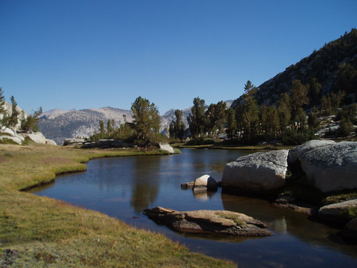
I set up camp in a little grove northeast of the lower lake outlet, hoping for a bit of windscreen. The wind wasn't howling the way it had been up on the ridge, but it wasn't exactly still either. I spent yet another lazy afternoon, reading and exploring the basin, every now and then ambling over to the slabs below the lower lake for a grand view of the Silver Divide. The wind finally died down around dinner time, and evening and night were blissfully peaceful. 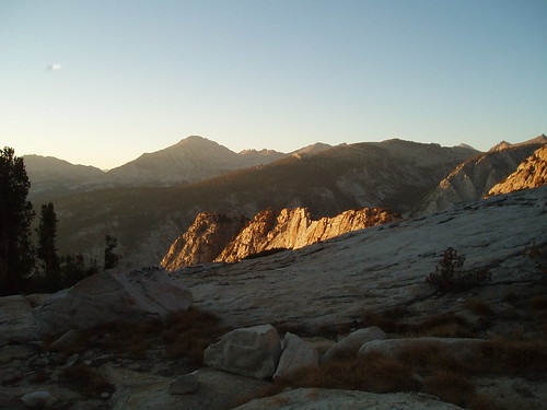
I got up well before the cracko, figuring I had a long hike out, and made a quick breakfast by headlamp light. Judging from my photo timestamps, I got on the trail around 6:30 or so. I followed the gully up from the upper lake to the top (the contact zone), and then retraced yesterday's steps up to the base of the loose stuff. Here I went for the slightly less loose stuff on the volcanic side, rather than fighting the sand I had come down. I headed south and up to the krummholz forest on Volcanic Knob ridge. 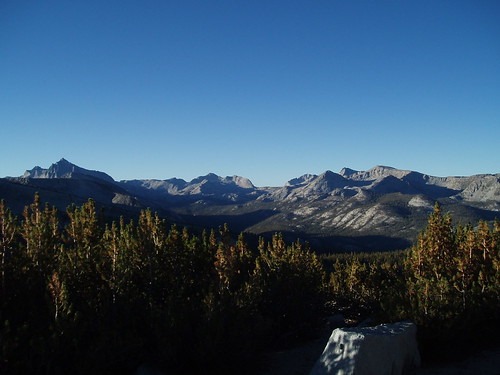
My plan at this point was to follow the curve of the spur ridge south then southwest then west, the idea being to hit the big meadow where I could find the trail again. Everything went beautifully, for a while--an easy stepped descent down gentle slopes and along meadowed benches. Then suddenly it was a lot steeper, in a place where it shouldn't have been steep if I had been where I thought I was.
After some puzzled map-reading, I figured it out: I had dropped too low on the southeast slope of the ridge, and was on the wrong side from where I wanted to be. I had to traverse west (and a little up, just to be safe) around the southern end of the ridge; when it got gentler, I knew I was in good shape again. I continued through the gentle forested slopes west to the meadow, where I found the trail.
From here it was a straight shot down, retracing my steps. To my surprise, when I got to the car it was just 10:30--I was expecting it to be a full hour later than that.
Another trip with some sub-optimal circumstances, that nevertheless wound up being an enjoyable, interesting, and spectacular adventure.
Saturday, August 25, 2007
Mono Divide Trip Report: Part 2
Subscribe to:
Comment Feed (RSS)
|