
There comes a time when everyone's plansOnce again, the trip I did wasn't the trip I planned. It didn't start out very well, but it wound up being a great (3-day rather than 4-day) trip to some truly spectacular and isolated spots.
Fall like a dog from a truckbed grandstand,
Fall like red snow on the freeway...
--Thin White Rope
Day 1
This was not a good day.
My plan was to take the Bear Creek Cutoff trail over to Bear Creek, then head up to the vicinity of Hilgard Branch--potentially a 12-mile day. Second day would be up to Apollo Lake, then over to Cirque on Day 3, and out via Marcella on Day 4.
I had been unable to get an advance reservation, so I had to wait to get a permit until High Sierra Ranger Station opened at 8 am. That meant I wasn't on the trail until 8:45, which is maddeningly late by my standards. It was already pretty warm by the time I started out, and obviously shaping up to be a hot one, which made the late start all the more annoying.
The day really went south when I was over the rim and heading down toward Bear Creek, and started wondering if I had locked my car. The further I went, the more certain I was that I hadn't. I really, really didn't want to go back (I was a good 3 miles in by now), and tried talking myself into a whole whatever happens happens type deal, all the while going further and further in. The thing that finally tore it (by which time I had hiked about 4 miles) was when I thought about the practical implications of the worst-case scenario: no wallet, no cash, no ATM card, no credit cards--no way to buy mogas to get home. That, as they say, would be bad.
So I turned around and slogged back to the trailhead, hot, tired, and demoralized. The car was, in fact, unlocked.
I did, however, have a plan to salvage the trip. I decided to car-camp that night, get an extra-early start the next morning, and do a 3-day version of my Plan B trip (which I had come up with when I couldn't get the permit reservation). This was to go up the Bear Ridge Trail to the JMT junction, then continue up a use trail to the lakes below Recess Peak. Then I'd head to the valley west of First Recess (skipping First Recess itself, which I'd have done on the 4-day version), or One Halfth Recess as I call it, then hike out on the third day.
So I lazed away the rest of the afternoon and camped that night at Bolsillo Campground--a lovely spot, if you like the smell (and sounds) of horses (but it's free, so you get what you pay for)--and worried about the next day's (net) 3200' climb.
Day 2
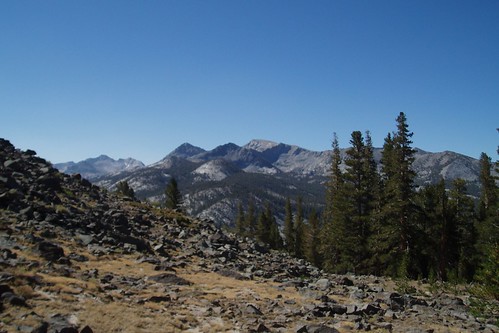
I was up at 5:15, out of camp by 6:00, and on the trail a little before 7 am. It was a little cooler this morning, and the trail was well-shaded (on the northwest side of the ridge, so it wouldn't get sun until mid-morning), which made the hiking a lot more pleasant. It's a sandy, sometimes-rocky trail, but the grade isn't too bad. The views aren't much (the flip side of the shade), but a couple miles in you get a nice look up toward the Silver Divide.
After about three hours of steady slogging, I got to the JMT junction, and the start of an unsigned trail up toward Recess Peak Lakes. This trail is easy to follow for the first mile or so, then peters out when it reaches the big meadow at 10,200'.
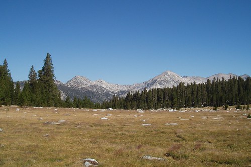
This area is an oddity on the Mono Divide: a sizable area of volcanic rock (not meta-volcanic, like the Minarets, but honest-to-god volcanic, as in an old lava flow) such as you'd find much further north, around Carson Pass or thereabouts. The local landscape is one of big sweeping meadows and wooded ridges, with the aptly named Volcanic Knob (it's a knob, and it's volcanic) presiding over it all.
Rather than try to track down the trail, I just climbed the gentle slope up the ridge east of the meadow. (I'm impatient with intermittent trails, and I'd rather just make my own way than try to follow a 'trail' that isn't clear.) From atop the ridge I was able to contour (more or less) into the big meadow east of the ridge. To my surprise, the stream there was flowing--a function of the volcanic landscape, in which water seeps into the rock rather than remaining on the surface.
I continued over the next slight ridge (back in granitic country) and contoured around the head of the next valley, then crossed a large area of granite and sparse whitebark (this is more complicated than it looks on the map, because you're going against the grain of the granite, and the route is cut with a series of small gullies). This took me to the north shore of the upper Recess Peak Lake.
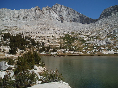
I dropped my pack earlier (not too long after noon) and feeling much better than I had expected--the benefit of an extra day of acclimatizing, an early start, and psyching myself up for the difficulty of the hike.
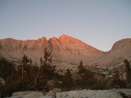
I ate lunch and spent another lazy afternoon reading, with occasional leisurely exploration of the basin. After dinner, as the sun started getting low, I went down to the western corner of the lake to catch the alpenglow, which I figured would be prime (Recess Peak facing due west and all). I was not disappointed.
Part 2
|