
First trip of the season was a short, not-too-difficult jaunt with my buddy Lou in Mokelumne Wilderness out of Blue Lakes--location and timing chosen mostly for the wildflowers. More...
When we left Friday morning, the Bay Area was blanketed in thick ugly smoke from hundreds of wildfires all over the state. Of course, if it was as smoky as this up in the mountains, there wouldn't be much point in doing the trip at all. The smoke continued through the Central Valley and into the foothills. By Carson Pass we were mostly above it; distance views would be smoky, but at least we had blue sky above us. 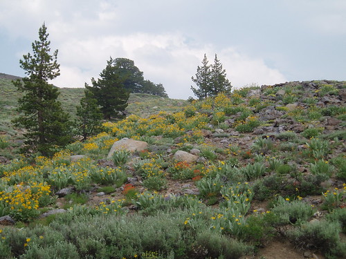
The road through Hope Valley delivered on the promise of wildflowers: mule ears, paintbrush, lupines, penstemon, and lots more. We snagged the last spot at Middle Creek campground between Blue Lakes, 1/4 mile from the trailhead. (Turns out there was another campground even closer, with lots of vacant spaces.)
We hit the trail around 7:30 Saturday morning. The trailhead had moved since my last trip here; it's now right by the boat launch, and you walk across a little bridgelet over the spillway to get to the trail. You follow the opposite bank of the runoff channel for about a hundred yards, then cross the outlet stream on a good log that's been there since Max and I first came here in 1996. Across the stream, we were briefly confused by a trail uphill that petered out in mud and snags; the real trail continues downstream a little ways before turning uphill. Intermittent snowfields and muddy patches were no more than a minor annoyance. 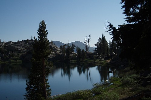
We took a short break at Granite Lake, where Max and I had camped on his first couple of backpacking trips. Lots of mosquitoes here--no surprise--so we didn't linger.
West of Granite Lake the views open up to the south. Lots of wildflowers all along here, especially penstemon. 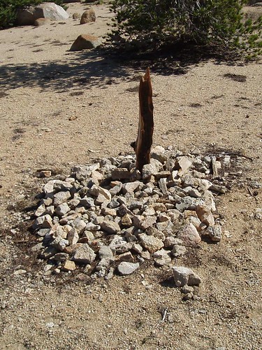
About a mile up the trail there's a spot marked 'Grave' on the topo. The marker doesn't say who's buried here (if it ever did), and Google is no help. Some anonymous prospector, I guess. 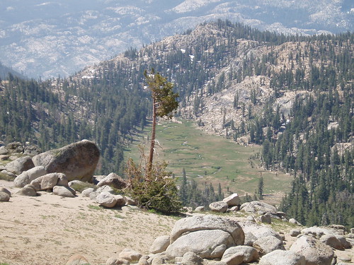
A little past the gravesite the trail runs 300' straight up a ridgelet (hello? switchbacks?) to a more-or-less level traverse above the head of Snow Canyon. The trail runs just below the contact zone between granite and volcanic rock above. You can trace the discontinuity on the topo along a series of springs: water is stored in the porous volcanic rock, and makes its way to the surface where it hits the impervious granite.
The trail petered out near a big snowfield on the near side of the ridge east of Grouse Lake. We angled up to a low point on the ridge, then contoured north and picked up the trail again. We lost it again dropping down a gully to the ridgelet between Grouse Lake and Grouse Creek (nice field of stickseed here), but the terrain was pretty obvious. We picked it up again after dropping a little to the north, and it stayed with us all the way to the lake. 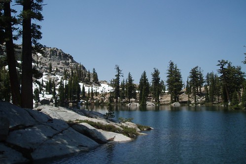
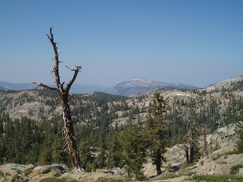
Grouse Lake is lovely, the perfect mix of granite cliffs and forested shores and views of the higher peaks. We turned the lake on the north side and angled up the low ridge to the west. We dropped our packs just before noon at a nice spacious campsite atop the ridge, with plenty of wind (to keep the skeeters down) and views of Summit City Canyon. 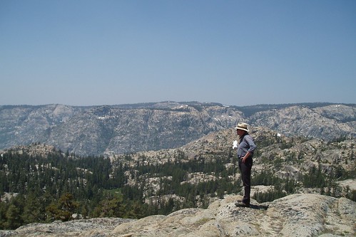
Spent the afternoon reading, exploring the lake, and getting my ass kicked at Scrabble.
Next morning we were on the trail around 7:15, headed for either Deadman or Snow Canyon (we figured we'd decide once we got a view from the top of the ridge. We backtracked on trail until the ridgelet, then set out across the Grouse Creek valley to climb the slope on the south side (visible on the topo map as a less-steep portion of the ridge, due north of the '2' in '21'). 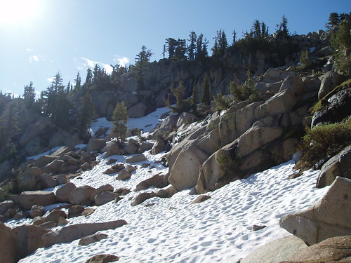
Not too difficult most of the way up, although near the top we had some loose sandy stuff and a couple largish snowfields to cross. We made the ridgetop before nine--early enough that there wasn't a lot of smoke to ruin the view. 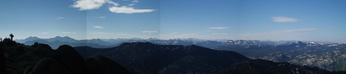
At this point, we decided to head for Snow instead of Deadwood--partly to have a shorter hike out (Lou's back was bothering him), and mostly because those swampy patches on the map promised big mosquito action. From the ridge we dropped down a shallow gully to the obvious wet meadow below. At the far end of the meadow, the fun began: we were going against the grain of the granite, a series of ribs and gullies trending maybe 45 degrees off our intended direction. With a lot of zigzag ups and downs and a certain amount of backtracking, we eventually made it to the big flat saddle between Snow Canyon and Deadwood Canyon.
From here a ravine (visible as a notch on the topo) angled northeast into the canyon, promising a direct route down. Or not. The ravine bottom got steep and narrow and chockstonealicious, we wound up sidehilling on some steepish loose stuff, and after a bit we angled out of the ravine altogether and onto gentler, more stairstepped slopes down into the canyon. 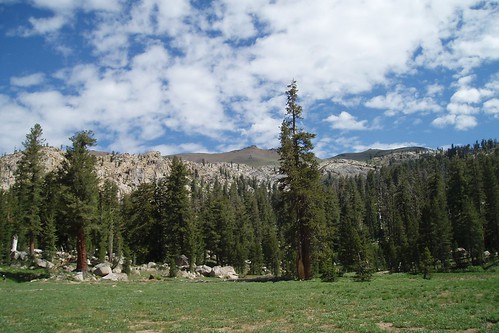
Snow Canyon is a great spot--a big flat half-mile-long meadow nestled in a forested bowl, with stark volcanic Deadwood Peak looming over it all. We snagged a swell campsite (complete with an elaborate illegal firepit, which of course we didn't use) in the woods at the northwest edge of the meadow, near the western tributary to the main stream. Mosquitoes weren't too bad, considering. Had another lazy afternoon reading, exploring the valley, and getting beaten at Scrabble (but by a much narrower margin).
Next morning we headed east, paralleling the eastern tributary stream up to the big meadowy bench at 8600'. Max and I had camped here once, on his first off-trail trip; there's a nice big open sandy area perfect for setting up shop. From here we went a little astray, angling away from the stream a little too soon and a little too far and winding up further south on the ridge than we had intended. Not huge; we followed the ridge north with only minimal scrambling, and caught the trail in the meadow northeast of point 8850. 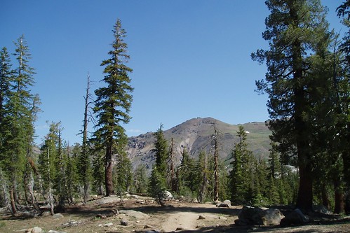
All uneventful from here, apart from briefly losing the trail in a snowfield. We got back to the car before 10 and headed home through surprisingly heavy and slow traffic on 50.
Great trip. Short, and none too ambitious; but it's some beautiful country, and we sure got the wildflowers we were looking for.
Thursday, July 17, 2008
Mokelumne Trip Report
Subscribe to:
Comment Feed (RSS)
|