
Announcing your intentions is a good way to hear God laugh.Back from a weekend backpack trip, with a story or two...
--Al Swearengen
My original plan was to hike out of Lake Edison, up Bear Ridge to the lakes west of Recess Peak. I left work a little after noon, picked up a rental car, and was on the road by 2:30. I sat through a 45 minute delay on 152 east from Gilroy; the rest of the drive was mostly uneventful. I got to the Huntington Lake/Kaiser Pass intersection around 8:30...
...and there were a bunch of emergency vehicles blocking the Kaiser Pass road.
So I asked a sheriff's deputy what was going on, and he told me the road had been washed out. Flash flood.
Damn...
So I thought about where I could go instead--some place where I could pick up the permit at the trailhead--and I came up with Kings Canyon. I could go up the Copper Creek Trail, do a night at Upper Tent Meadow (and scout the location for my August trip), and a night at Grouse Lake. It was all territory I had covered before, but it would be some kind of backpacking at least.
I got back on the road and drove another 3 hours, down 168 to Fresno then back up into the mountains on 180. I pulled off on a dirt road about 5 miles past Grant Grove, found a wide spot to park, and crashed out in the passenger seat around 11:30.
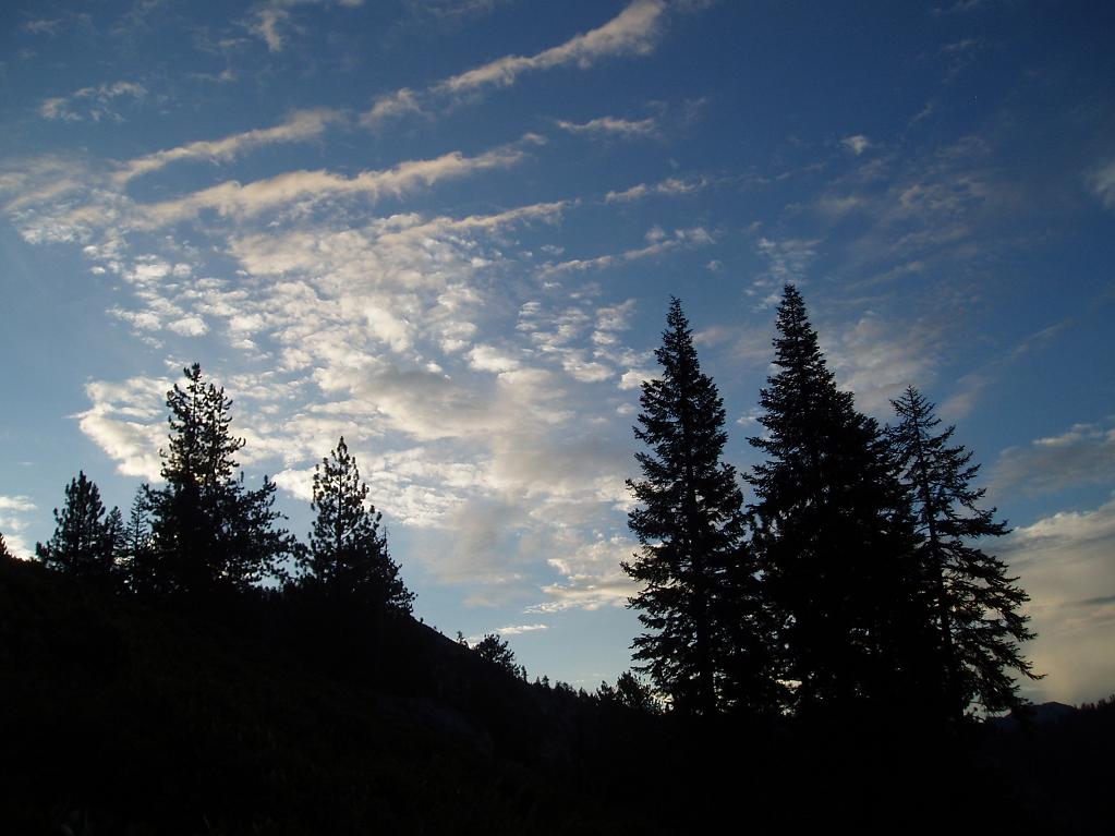
Around 4:30, I decided it would be getting light before too long, so I might as well get up. I walked a little ways up the dirt road just to stretch my legs, and came to a spot with an open view to the west, looking out at the lights of the Central Valley 40 miles away and 7,000 feet below me.
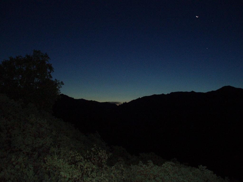
On the way to the trailhead, I got some shots of the peaks silhouetted against the predawn sky.
I got to Road's End by about 6:15, made myself some coffee, and waited for the ranger station to open at 7:00. I picked up the permit and a bear can, and was on the trail by 7:30.
This was a good move because a) I had a 3,600' climb to the first campsite, b) the first 1,500' or so are mostly shadeless and exposed to the southeast, and c) it was the middle of a record-breaking heatwave. As it was, I managed to gain a good 500' or so before the sun hit. It's a well-graded trail, the kind you can make steady progress on without having any really steep sections, but as the day got hotter the going got more difficult. The final approach is a long shadeless traverse through an area burned over about 20 years ago. I dragged my ass into camp at Upper Tent Meadow sometime after noon or so.
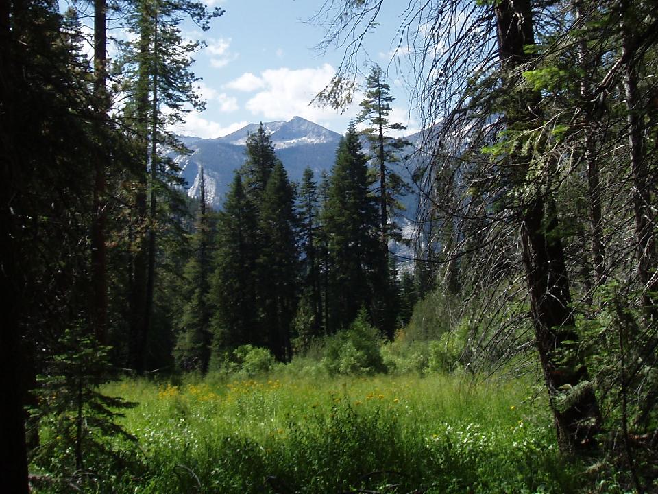
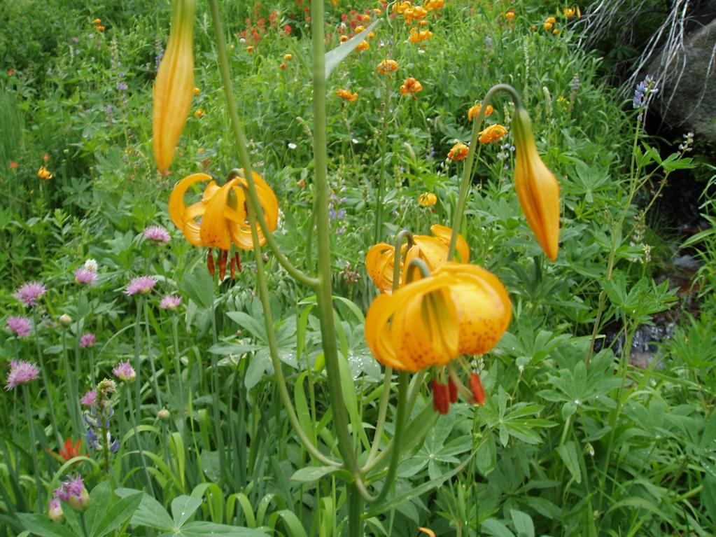
I had last camped here 26 years ago, and had very little memory of the place. The ranger told me she had never found it, and it isn't obvious; you have to follow a faint use trail off the end of a switchback, cross a steep stream on wet rocks, and thrash through mud or alder (your choice) to get there. It has just a handful of tiny flat sites scattered over the slope; finding space for a large group would be a nightmare. But I was alone, so it didn't seem to be a problem. Wildflowers were in abundance; so, alas, were mosquitoes.
I dropped my pack and prepared to settle in for a long afternoon of reading my book...
...which, I realized, I had left at the trailhead.
Damn...
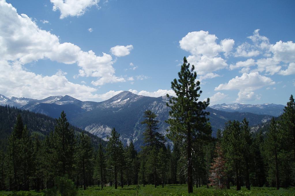
So I played cards and watched the clouds gather. The thunder started, but no rain...and that's pretty much how the whole afternoon was: a couple of hours of nearly continuous thunder, and only sporadic and desultory precipitation. It was still overcast after dinner, and the bugs were pretty bad, so I crawled into my tent and played solitaire for a while.
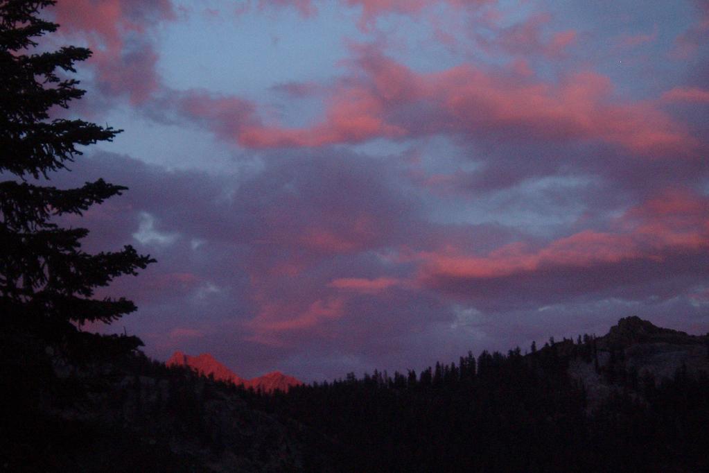
I started getting curious about how much daylight was left (I didn't have a watch), so I poked my head out of the tent...just in time to catch a spectacular sunset. I barefooted it over to the pack and grabbed my camera in time to get a few shots of it.
Next day dawned mostly overcast--always a bad sign. Red sky at morning, and all that, except it was grey instead of red. Based on the threat of thunderstorms, the bugs, and (most importantly) my lack of reading material, I decided to bag the second night--that I could do a (packless) dayhike in the morning and enjoy the best of the day, without dealing with hours of ugly weather in the afternoon.
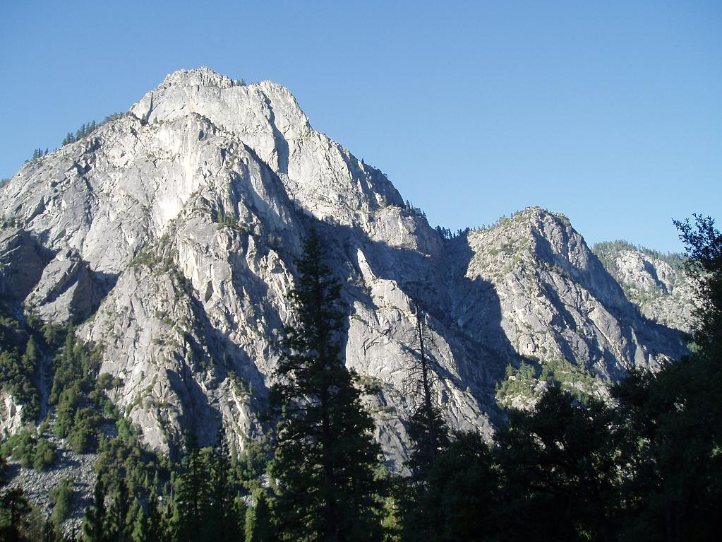
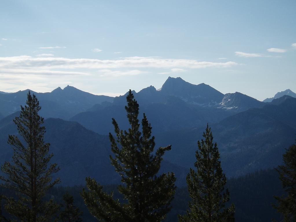
The sky cleared some as the morning progressed, but there were still enough clouds to promise some afternoon weather. I hiked up to the rim of Granite Basin and wandered around up there for a while, enjoying views into the basin and, to the east, the distinctive profile of Mt. Clarence King.
When I got back to the campsite I packed up and headed out of there. Down is a lot easier than up on this trail, so I wasn't expecting any problems...and for most of the way I didn't have any. At the last stream, I passed up the chance to refill my second water bottle, thinking a quart would be plenty for the hour or so left.
Wrong.
The heat down in the valley was brutal, and I felt more and more enervated as I went along. When it's as hot as this, you can't drink enough to stay hydrated no matter how hard you try. I finished my water with about a quarter mile left to go, and realized that I wasn't sweating--never a good sign. At the trailhead I dumped my pack and hightailed it over to the faucet by the ranger station, where I drank about a quart and a half of water and dumped another quart over my head. Not stopping to refill was an incredibly stupid mistake I won't make again, at least until I've forgotten about this particular misery, at which point I'll probably do something equally stupid.
Anyway...not the trip I planned, certainly some sub-optimal conditions, but enjoyable nonetheless.
[That's all, folks]
|