
Part 1
Part 2
Part 3
On Monday I got up promptly at 4:53 am. No lolling in bed for me: I had a tough and uncertain route ahead of me, and I wanted every possible time advantage in undertaking it.
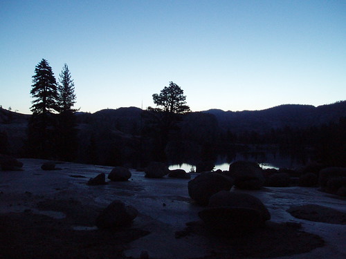
The first part went beautifully, thanks to my scouting the previous day. Just above the southern edge of the forest on the west shore of Flora Lake, there's a sort of loose path up to the higher level of slabs (otherwise it's mostly cliffy at the base of the slabs). From there, just angle south as you ascend the slabs, and you can't go wrong (if you hit the outlet creek, just follow it up to the lake).
From the lake, it looked like I had three options: follow the higher slabs to the right (looking west); go past the lake (some brush here) to the slabs directly behind the lake; or cross the outlet stream to what looked like an open, slabby route on the other side of the lake. I picked Door #1, and that turned out to be perfect. Follow these slabs to the very top (angling a little bit right); in early season, you'll cross a small stream draining the tiny tarn at 7440+ close to where the slabs end.
And this is where the fun begins. Keep heading due west upslope, over lots of down trees and through copious brush. It opens out a bit (but not at ground level--still brushy), and you'll see a rock outcropping above; just keep heading for the outcropping, and if you can find the 'trail' follow it (slightly less brushy that way). From the outcropping, you keep heading west across the flats, through an older burn area (tons of down trees, plus a dwarf forest of something or other). 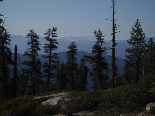
Once you start climbing the next slope up, it opens up a bit, and you even get the occasional view. At the top the walking is fairly easy. Schifrin's route follows the ravine south of point 7697, so I contoured a little lower than the high point and started traversing down the ravine, keeping a careful eye out for the 'trail' Schifrin refers to.
Nothing.
After a ways with no sign of 'trail', I got to wondering...so I checked the map again. And realized I had started down the wrong ravine--the one SSE of point 7761. Which, if I hadn't caught it, would have been very very bad.
Fortunately, I hadn't dropped far, so I cut over the ridge and hit the right ravine, on the far side of which I found occasional footprints. Good enough for me.
The key here is to stay highish on the side of the ravine, and not drop too far into it (the ravine turns southish, and you really don't want to do that). When you spot a valley more or less perpendicular to your line of travel (which should be WSW at this point), just go straight across it and you'll hit the broad flat at the top of the ridge. Lots of down trees and some brush (do I even need to say it at this point?), but otherwise not too bad in this stretch.
From here, routefinding is pretty simple: just stay on top of the ridge and follow it WSW to the trail. Where the ridge narrows and a ravine drops off to the left, be sure to stay right. Where a shallow valley opens up on the right, you can drop down into it for easier walking. That valleylet ends and another opens up on the left; drop into that one, and it takes you directly to the trail.
Which I hit around 8:30, relieved that the cross-country was over, happy that it went as well as it did. Definitely some tough terrain, but no worse than I was expecting, so it was all good. 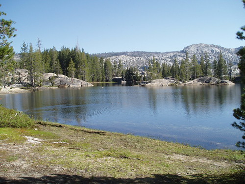
Not much more to tell after this. 50-yard detour to Kibbie Lake, wet-boot crossing of Kibbie Creek, endless boring trail back to the Kibbie Ridge junction (literally endless: I'm still hiking on it, and always will be), another mile or so back to the car. I was actually a little disappointed not to run into anyone along the way (the last human I had seen was on Kibbie Ridge, on Friday).
Despite some negatives (Lou having to bail, the abortive Nance Peak climb, the long boring stretches at beginning and end), this was a good trip into some very pretty and isolated country.
Wednesday, June 06, 2007
Northwest Yosemite Trip Report: Part 4
Subscribe to:
Comment Feed (RSS)
|