
This was a nine-day trip out of Road's End (Kings Canyon National Park) to a series of remote, off-trail lake basins on the Monarch Divide...
It was a Sierra Club trip, but it was a little different because there were only two trip members and myself. That meant paring the equipment set down to the absolute minimum, streamlining meals, and keeping a sharp eye on food weight.
I met up with Gene and Renee at Sentinel Campground the evening of August 7. Next morning we packed up and at 6:45 I headed off to the packer to drop off our gear and food, which they would carry up to Upper Tent Meadow. I met up with the others at Roads End.
My hope had been to get on the trail by 7:30; we had a 3700' climb, with the first part on exposed southeastern slopes--in other words, a long, hot slog. The ranger's late arrival, another hiker ahead of us, and an excruciatingly slow permit process pushed that back to 8:30. Happily, the day was not as hot as it had been two weeks before, but we did have a fierce sun on us from the very beginning. The good news is that the trail is well-graded, and taking it at a slow but sustainable pace we made good progress. 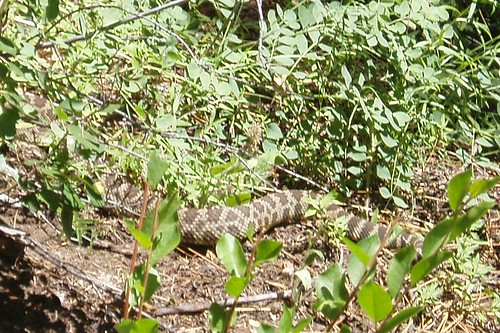
We saw this rattlesnake (and heard it, hissing and rattling) a couple miles in, at about the 7500' level. It's a little unusual (but not unheard of) to see rattlesnakes that high; then again, back in 1864 Brewer killed one at 10,000' on the Monarch Divide.
We continued to make steady progress, and even with a leisurely lunch stop we made it to Upper Tent Meadow by 1:30. We got there just after the packer, who was still unloading when we pulled up. We crossed the stream and dropped our packs, then came back to shuttle our load from the trail to the campsite--an awkward endeavor, as the route includes mud, brush, and rock-hopping, but we got it all in two trips. Each of us found a more-or-less semi-level campsite (it would have been very difficult with a larger group) and we settled in for the afternoon.
After dinner and food-hanging, we all headed over to the rocks southwest of camp, where no trees blocked the view. Renee spotted a black bear across the canyon, ambling lazily down the mountainside, showing no interest in us or our food. We stuck around to watch the alpenglow (this became a nightly ritual for the rest of the trip) and moonrise (a day short of full).
Next morning was the moment of truth--hiking with all our food and gear--and as we divided up the load I realized I hadn't done as well as I'd hoped at keeping the food weight down. A normal 9-day trip starts out with a commissary load of 16-18 lbs.; we had 20-21 lbs. apiece. With heavy, bulky packs on we started up the endless switchbacks to the lip of Granite Basin--a 1600' climb. I find this stretch demoralizing: there are always a few more sets of switchbacks than I expect (even when I just did the trail two weeks before); the trail crosses the ridge higher than is really necessary; and even after you get to the 'top', you still meander for a quarter mile or so further up the ridge. Eventually we got there and took a hard-earned break.
But even then our labors were hardly over. The trail through Granite Basin is rocky and uneven, impossible to get a good hiking rhythm on, and full of frustrating little ups and downs that net out to a heartbreaking 300' drop before the climb back up to Granite Pass. We were also getting low on water--there's really no easily accessible water between Upper Tent Meadow and the streams a mile and a half into Granite Basin. Add to that our overloaded packs, and you get...not much fun.
Also: mosquitoes. 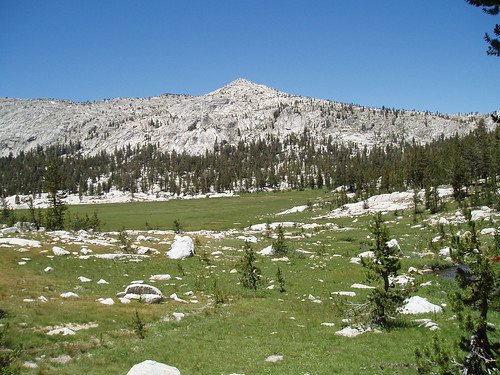
The big meadow in Granite Basin was a lovely reward for our efforts...but it didn't make our packs any lighter. It did signal the beginning of the 600' ascent to Granite Pass, which starts out gradually and winds up in steep switchbacks up a south-facing gully. 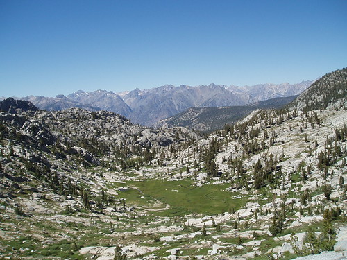
By the time we got to the pass, I was pretty well spent and fairly demoralized. We sprawled there for a while gathering our strength for the last brief leg of the day's journey.
That part went pretty well, considering. We followed ramps east from the pass up to Lake 10,785, and stumbled into camp around 3:30. 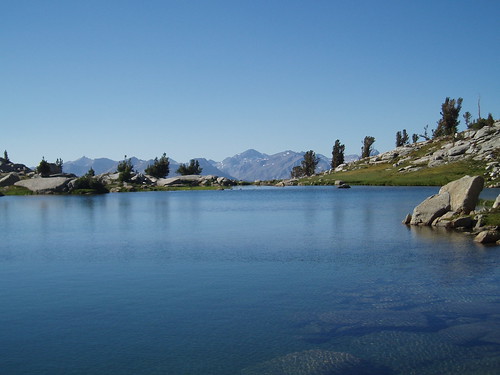
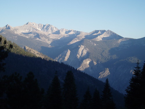
When we got to the lake, everything changed for the better. It's a spectacularly beautiful spot, with views of Goddard, the Black Divide, the White Divide, and even a portion of the crest. What's more, we knew the next day was a layover--rest, if we needed it, or hiking without a pack if we felt like it--and that when we moved again it would be a few pounds lighter. 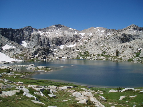
Next morning Renee and I dayhiked over to Volcanic Lakes, while Gene stayed in camp. Volcanic Lakes is a lovely basin, and well worth a visit, but I was more than happy visiting it on a dayhike and staying at our little unnamed lake. On the way back we saw (from a distance) a group of hikers heading up the trail to Granite Pass--the last people we saw until the last day of the trip.
Part 2
Part 3
Part 4
[That's all, folks]
Tuesday, August 22, 2006
Monarch Divide Trip Report: Part 1
Subscribe to:
Comment Feed (RSS)
|