
Part 1
Part 2
We had another leisurely morning (kind of a pattern for this trip) on day 4, leaving camp around 8:15. Another short day; our destination was Ward Mountain Lake, just the other side of the Ward Mountain ridge.
We circled around the north side of Lake 10200, crossed the outlet stream, and picked up a nice gentle ramp leading up to the west. From the top of this you can take any combination of fairly easy ramps, as long as you keep heading generally northwest. The goal here was a notch that leads to a grassy gully on the other side; it's the only real break in the cliffs on this part of the ridge.
We got to within sight of the tarn east of the ridge, and here I led us a little astray, up a nice-looking route straight up to the ridgeline. (What I should have done was pass the tarn and climb up to the ridge from its north side.) That meant we took a few minutes to scout out the right notch in the ridge, which wasn't a big deal, but I was annoyed with myself for not hitting it perfectly. For future reference, the correct notch is right up against the southern end of the fin.
The gully down is steepish but not too intimidating; take it slowly and carefully and it's no problem at all. When you start seeing forested slopes on your left, you can cut over and avoid the brush-and-talus-choked lower end of the gully. Follow the forest-and-bedrock slopes down to a bench and cut left again (along the bench), then cross another small drainage onto low-angle slabs that take you the rest of the way down. 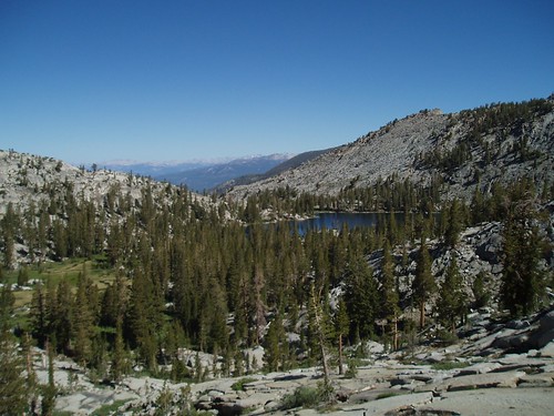
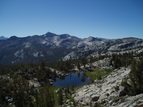
We stayed pretty much on the slabs to circle the big meadow on its west side (lovely meadow, by the way, but meadow = mosquitoes). There's a bit of a use trail that follows the west side of the lake, taking you directly to a snagpile crossing of the outlet stream. Very little water in there this time, but three years ago it was a little hairier. Across the stream, go up a low rise then down a shallow gully then up another rise to a whole mess of excellent campsites. That's where we dropped our packs. 
This is a great spot for hanging out: the lake is beautiful, there's plenty of shade, and there are good rocks to sit on. We had yet another lazy, relaxing afternoon, the one low point of which was Lou seriously kicking my ass at Scrabble.
Now, a word on mosquitoes. It was dry out there--really, really dry for this time of year. Those of you who are familiar with the Sierra will have seen that in the photos, which look more like mid-August than early July. Streams were down, snowpack virtually non-existent, hardly any flowers. Dry, dry dry. The only thing that wasn't symptomatic of mid-August was the mosquitoes. They weren't at peak season levels--they pretty much just came out in the early morning and the evening--but they were a presence at every campsite. This one, Ward Mountain Lake, worst of all. Just to make things worse, it was a warm evening, so mosquito activity didn't really subside until after 10 pm. Most annoying.
The last morning we were both up promptly at 5 am in order to get an early start. There was already a warmth in the air--obviously it would get pretty hot, and we wanted to finish hiking before the worst of it. Also, today's route was biggest question mark in our trip. Three years ago, descending from Ward Mountain Lake, I had dropped too far and wound up tangled and thrashing through the bottomlands, a hellish expanse of brush and crisscrossing down trees and the occasional swamp just for variety. To avoid that fate, we had picked out higher traverse that looked doable but was still highly speculative; you're never quite sure when the lines on the map are hiding some horrible big block talus field, or when the unforested area is actually willow and manzanita.
So to give us the greatest possible time advantage, we hit the road by 6:30.
The first part is easy: from the rise northwest of the lake, follow a gully down and then keep dropping on gentle ramps, angling more or less toward the outlet stream. (There appeared to be a ducked route, but it looked more complicated than what we did; in any case, you can't go too far wrong in this stretch.) Cross the outlet stream right where it begins dropping into a narrow ravine. Continue northwest, dropping on a series of benches, until you get to the base of a cliff a little below 9300'. Contour westward (more or less) into a shallow valley of big slabs and open forest. Cross this valley to the shoulder opposite, gaining another 50' or so along the way. 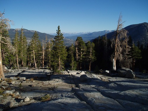
Now you're in the steepest section of the route. Stay between 9300' and 9400', and where you see traces of trail follow them. There are a couple of talus piles and a stream (not on the 7.5' map--do not confuse it with the Mt. Shinn Lake outlet stream) before you turn the corner into the drainage you mean to descend. Once you do turn the corner, the surest route is to angle toward the stream (use the granite ridge opposite as a guide) and then follow it down to the confluence.
From the confluence, we climbed back up out of the ravine and began dropping down the slope to the slabs. It didn't really matter where we hit them--the only thing we could do wrong would be dropping too close to the stream and missing them altogether--so besides angling leftward (west) I didn't much care just where we went. The drop took a lot less time than the climb had, and in a little while came out onto the slabs near the eastern end. We crossed back and dropped slightly to cross the Thompson Lake stream a little above where we had crossed on the way in. 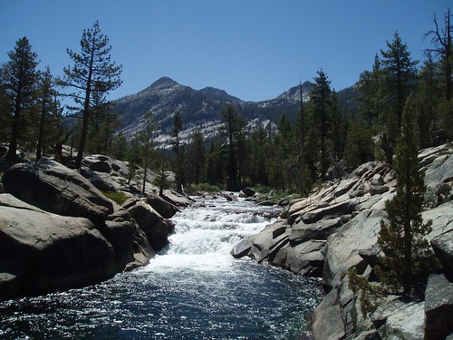
We followed the trail (such as it is) back to the main trail and got to the bridgea little after 10:30. The endless last mile was, of course, endless, but we got to the ferry landing a little after 11:00. It was getting pretty hot by this time, and the lack of shade was sub-optimal, but the boat was on the way.
The pilot (captain? whatever) turned out to be Luke, the groom from Sunday's wedding; Hillary came in at the head of a pack train, and the two other passengers on the boat were among the last remaining wedding guests--an appropriate coda to the wedding madness in which we had started our trip.
As I said--not the trip I planned, but a great trip anyway, with spectacular scenery, interesting and challenging cross-country, and good company. 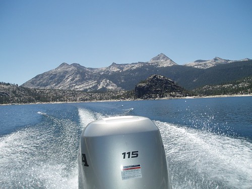
Wednesday, July 11, 2007
LeConte Divide Trip Report - Part 3
Subscribe to:
Comment Feed (RSS)
|